Saturday, September 30, 2006

The North Side (Tioga Peak Series)

(GPS: N37 56.938 W119 14.760)
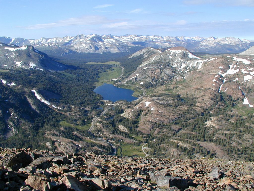
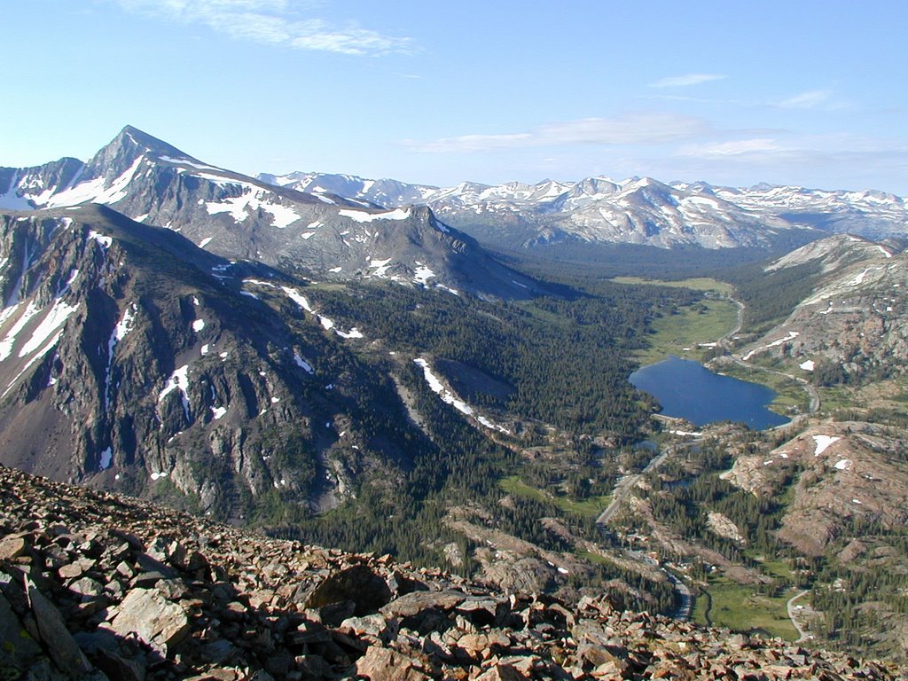
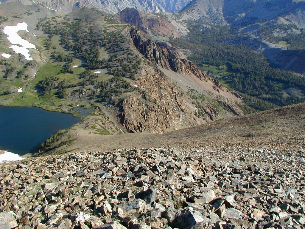
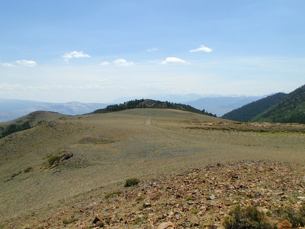
Looking at the northern side has good scenery too. The picture below is still looking west past Tioga Lake. You can see a lot of the high points of Yosemite. As we work our way to the right side north of Tioga Lake we pass by the ghost town of Bennettville. I am going to skip talking about that area for now and leave that for the next entry since I went there a few hours later that day. 
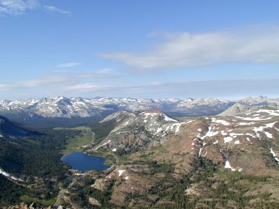
The main high point is Conness Peak in the middle of the picture. North Peak is to the right of that and Saddlebag lake is to the middle right of the picture. Later that morning I went to Saddlebag in order to find the trail head to get to Conness. I eventually decided that this was not the year for that hike due to my right foot being a problem. At the very tip of Conness you can see how it is a shadow. This is due to the clouds starting to get darker and covering the area at the time. It still was not too bad when I was up there. That would change on the way down.
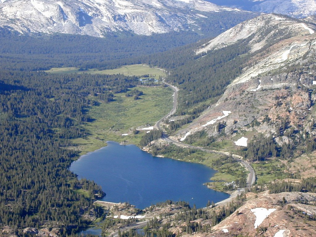
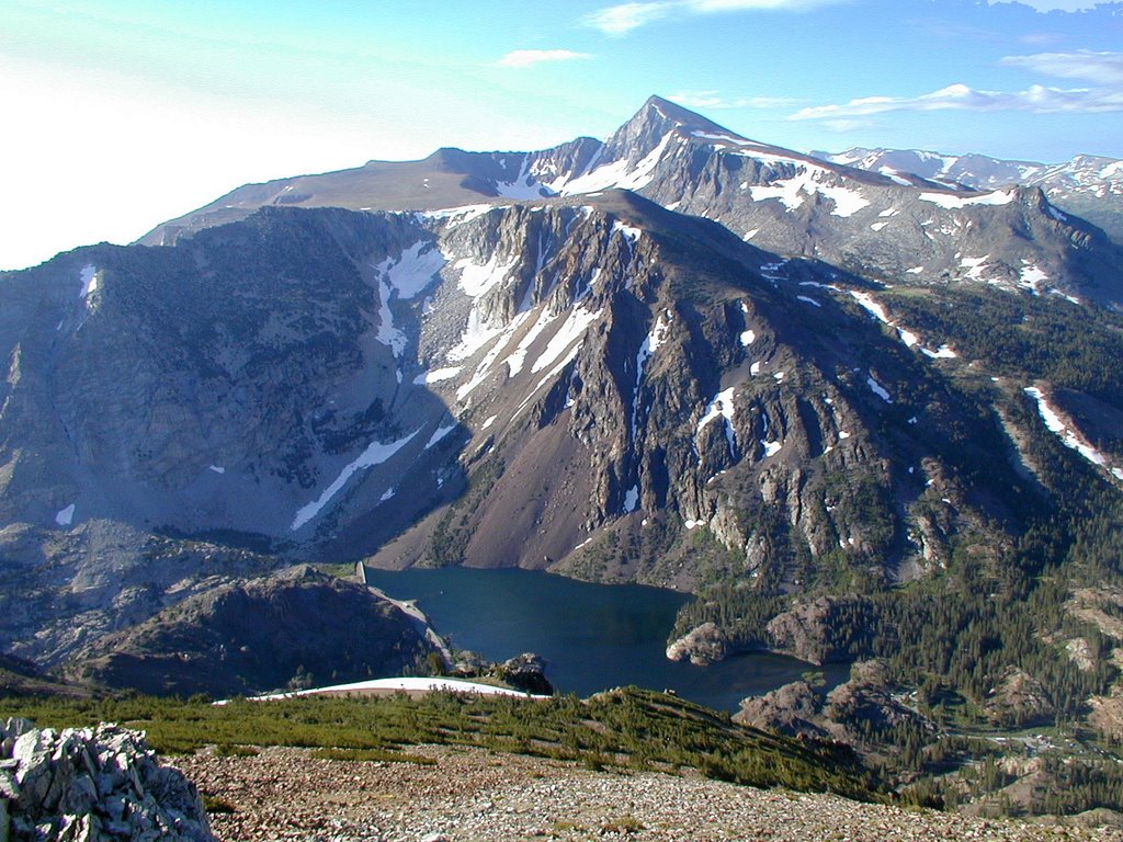
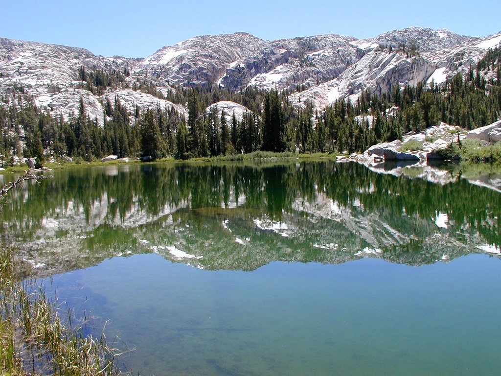
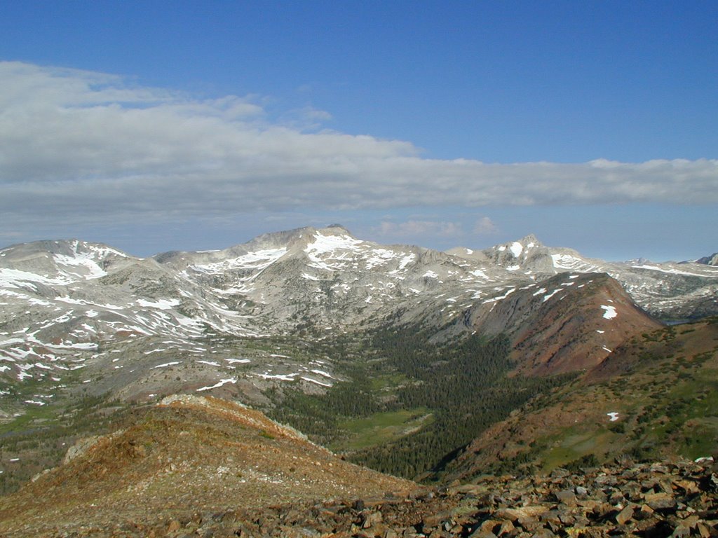
This is below Conness and it is interesting because you can see a small little house in the picture. It is the Carnegie Institute that was used for science in the past. I have read about it, but never been to it.
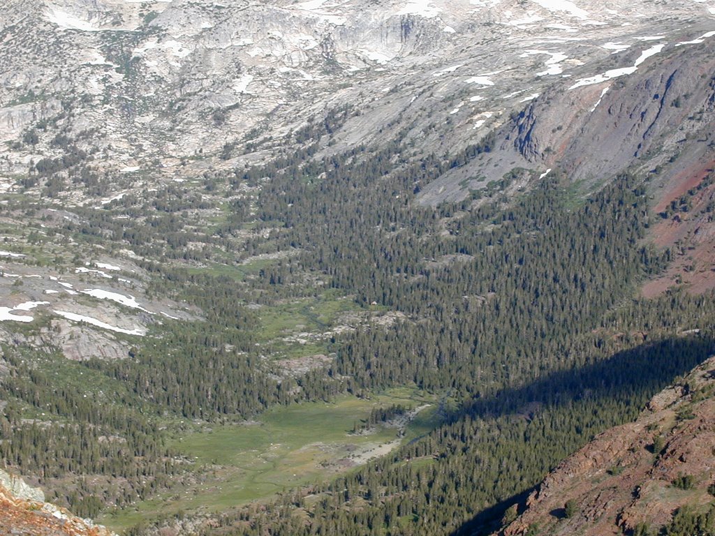
I spent about an hour at the top of Tioga Peak. I did not think it was going to be as scenic as it was so I ended up spending a lot of time taking pictures and using my camcorder. However, one thing I know of in the area around Conness is that the weather can take a dramatic turn. The clouds started to get darker. I decided I had better start moving down to avoid being a victim of lighting strikes.
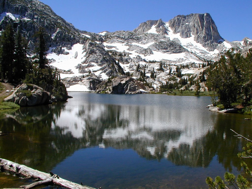
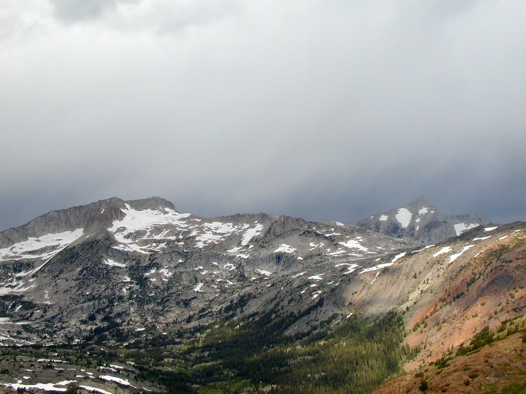
While I was going down it really never rained very hard. Just enough sprinkling to make me want to continue down at a good pace. I was expecting it to come down at some point.
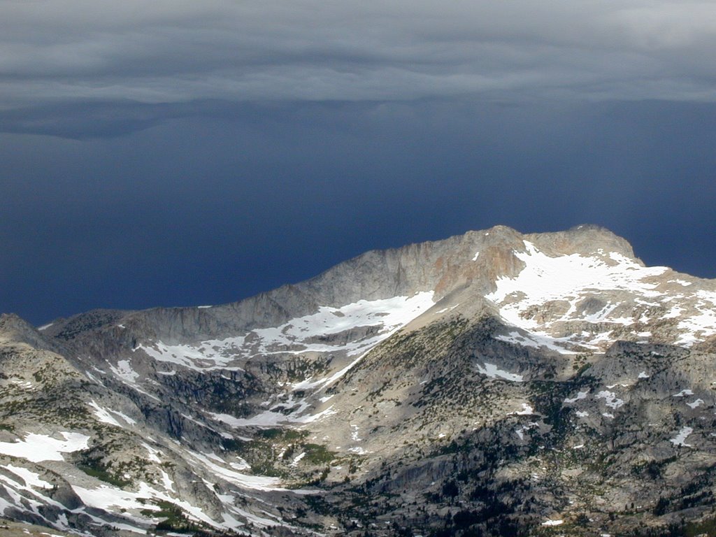
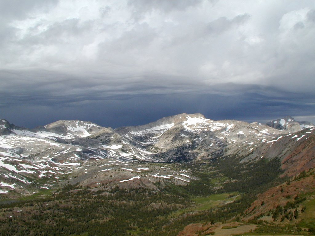
Darker and Darker. When I eventually got down and drove to Saddlebag lake a mile or so up the road it did come down pretty good with hail for a few minutes. It was not a long shower that morning. I went to Bennettville and made the short hike with it being overcast. Still the time coming down from the peak made for some dramatic gray pictures.

Monday, September 25, 2006

The West and South Side (Tioga Peak Series)

(GPS: N37 56.938 W119 14.760)

Looking down to the west side from Tioga Peak one can see Tioga Lake. Tioga Lake is one of my favorite lakes in the Sierra. It border the entrance to Yosemite which you may be able to see up the road. What is fun about this picture is you can even see the rock in the lake that is obvious when you drive by the lake. It was really great to see this lake from above.
This is a bigger zoom shot of the area:
It was fun seeing all the cars driving up to and by the lake:
The following pictures are starting to look in the southern direction. You can see Dana Peak. Which is the 2nd highest peak in Yosemite at 13053 ft (Lyell being the highest which is somewhere behind it).
Looking more south. Dana in the background and Ellery Lake below:
A bigger zoom shot of Dana Peak:
I remember rowing a boat in the middle of the lake, but closer to the back right side of the picture and hitting the bottom when I was younger. A very strange experience. My dad said he enjoyed trolling for fish here with my Uncle years ago.

Sunday, September 24, 2006

Gardisky Lake (Tioga Peak Series)

(GPS: N37 57.340 W119 15.160)
Over the next few entries I will cover many different areas I did on that day I hiked a few places off the 120 highway. If I could pick two days of my most recent trip to the Eastern Sierra that I was the most at peace and happy this would be one along with the Snow Lake trip. I woke up early that morning just intending to go to Gardisky Lake and scout some areas near Saddleback Lake for a possible hike to Mt. Conness at a later time. Although I never did ever climb Conness this year due to my right foot being in a lot of pain during this trip; hiking on scree and snow terrains at an angle up a high elevation was not a good idea this year. I wanted to get home in one piece and knew I had some limitations this year. However, this hike ended up being a really great substitute looking back at what happened.
The picture above is just shows you what it was like that morning at around 7:00am. I am looking back at where I hiked in from. People say it takes about an hour from the trailhead, but even with my bad foot it only took me about 30 minutes. The climb on the trail is steep for people that are not in good shape. It was no problem for me really and was a good sign for me that I could do a lot more than I intended.
This is actually later in the day before I left the lake. I thought I would show these than the shady morning shots. At the other end of the lake the water drops off the edge forming a waterfall that goes down pretty far into the canyon.
This is more of the same direction. This lake did look like a good lake to hike and fish at. It was a good size for that.
The picture above is looking up at Tioga Peak. I looked at it and thought, "Hmm, maybe I should just go and see what I think." I started up it and all it is is granite rocks. It ended up taken me about an hour from the lake. I started out thinking I would not make it, but as I kept going I realized I just needed to go a little further and further. Next thing I knew I reached the summit. It is a relatively easy peak hike. Most peak hikes with good views taken me hours to do. This one was a total of 1 1/2 hours of total hiking time from the trailhead. The views are really good looking into Yosemite. Looking back east to the Mono Lake area was not that good so most everything I have is shot from the north, south, and west directions. Here are a few examples until the next entry:
This is looking back down at Gardisky Lake from the top. Saddlebag Lake is to the high left of the picture.
This is a zoomed in shot of Gardisky Lake.
You can see the drainage of the lake over into a waterfall.
You can see the water drains into the Canyon. There is obviously a lot one could investigate from this lake on top of the other side.

Saturday, September 23, 2006

Gene Autry Rock Area in Hopalong Cassidy's False Colors (The Alabama Hills Series)

(GPS: N36 36.240 W118 07.025)

This is probably the most famous rock formation in Alabama Hills. The big protruding one is Gene Autry Rock. I have seen it a bunch of times in films. What you see below is the Autry Rock along with some of the rocks in the background. This particular movie picture is from Hopalong Cassidy's False Colors. Hopalong Cassidy is with some of his side kicks in the between the two major rock formations.
I shot the background rocks which look about right. However, the Autry Rock is shot back towards Lone Pine Peak. That is why it looks backwards in the pictures. In the following picture I added a picture from the Gene Autry movie Boots and Saddles which is why this rock was named after Gene.
Gene Autry Rock (Youtube Version)

Gene Autry Rock (Vimeo Version)

Friday, September 22, 2006

The Simpson Mine Part 2

(GPS: N 37 58.746, W 119 10.577)

This is the main structure at the Simpson Mine. It was definitely interesting to see this at a higher altitude.


Thursday, September 21, 2006

The Simpson Mine Part 1

(GPS: N 37 58.746, W 119 10.577)
After my hike to the previous entries area, I walked about five minutes to the northwest to the Simpson Mine. It is one of those areas that remains somewhat a secret in the High Sierra. As I mentioned in the last entry the people in the town of Lee Vining tell me they do not like too many people going up there because they are concerned about the dirt road being destroyed by vehicles. The other thing is people are concerned about the artifacts being stolen by thieves. The area is protected by the U.S. Government so do not even try.

The area reminds me a bit of Bodie ghost town. A lot of the structures have stood the test of time through the years of harsh weather conditions. Originally gold was found up here around 1890. Although a claim was filed later, a man named Jim Simpson purchased the mine around 1910. Simpson along with his brothers worked on the mine as much as they could, but during the rough winter months they had to stop. Eventually, the mine was purchased by different companies a few times. Most of what is seen now is what remains during the 1930's era.
I took a lot of pictures of the area. What I have posted here are some of the complete structures away from the main building. I will do a write up of the main building with pictures in the next entry.

Wednesday, September 20, 2006

An Awesome View of Mono Lake

(GPS: N37 58.645 W119 10.150)

One of the obvious scenic areas I drive by every year at least once, if not more, is Mono Lake just off the 395. It is a huge salt lake in the Eastern Sierra not too far from the Nevada border. I did some minor hikes near the lake, and to be honest, the more the sun comes out the worse I feel. It is a lake, but I feel like I am walking in a desert. This year I went up above the town of Lee Vining and took some pictures near an old mine. I did actually hike up there which is a story I do not really want to get into. One can drive up there, but the people in town do not recommend it mainly because they do not want the traffic on the road. They do not want the road damaged more than it is.
I do not believe pictures do justice to this area. It was very dramatic. The clouds were perfectly mirrored on the lake. The ledge of the area I shot this from was very epic and everything was so big. At one point a helicopter was flying below me over the lake. The one word I would really use to describe this scenic view is WOW! The following is a composite of two pictures. They are not perfect, but the best I could do to show you how the whole lake looks if you are there.
This next picture is looking south. I actually walked down this way when I left. There is a way up and down forming a loop. Yes, I did walk the road up and down. I would not recommend that unless you are really in shape. It took me a few hours to pull it off.
The following is looking northwest. Lee Vining Peak is to the left. You can see some of the old mining structures to the left and the right if you look closely. These are part of the Simpson Mine artifacts left up there. I will probably show some of the structures up close in my next entry.

Sunday, September 17, 2006

The Snow Lake Hike

(GPS: N38 06.010 W119 27.620)

This was a fun hike in August, 2006. A week earlier I intended to do this hike, but the problem was I spent too much time at Peeler Lake. I was well adjusted to the high altitudes a week later so I decided to do the hike again. I was on the trail around 4:30am and was remembering the hike I did a year to the day before to Matterhorn Peak a few miles away (that epic story for another day).

A hiker had tried to convince me to take a left at the junction side the week before. I had my goal of getting to Peeler so I had to ignore his advice that day, but realized what he was trying to say. This hike is a lot more interesting and it is BEAUTIFUL! After taking a left at the junction it does not take too long to reach Robinson Lakes.

These lakes are very green. The moss must make these lakes ultra green. They were not that big, but very nice to look at. These lakes dump in and join the Robinson Creek drainage that goes into Upper Twin Lake at Mono Village. I did some some small fish in them, but nothing really big. I was in the middle of the trail for both of these shots; the trail divides the two lakes.

After a while of more hiking I reached Crown Lake. This is the lake many camp at and reach from hikes from Virginia Lakes. Very BEAUTIFUL! While hugging the right side of this picture where the trail continues I heard a "bark". I thought there must be a dog out there. The problem is no dogs are allowed in Hoover Wilderness! It was either a human faking a bark or some other animal. I never found out. Finally, After about 4 1/2 hours I reached Snow Lake. It is about a 3,000 foot elevation hike. Lots of switchbacks! However, I never really felt that tired doing this hike. The conditions were cool and I encountered no humans at all. Only one deer on the way that did not want to get off the trail for me. I told him I would move around him, and I did. In the following picture I am shooting back to where I came from on the left side of the picture. The lake drains down below, but it is not a waterfall. There was a patch of snow at the end that I had to get off trail for, but no major snow. I would have been upset if I had not found a way to get past that snow. I was so close! The Sparkletts Water picture. I spent some time on the other side of the lake to the right. It is very marshy there. Unfortunately, I do not think pictures really do justice to the beauty of this lake and area. I was so at peace at this lake. I did have to deal with a lot of skeeters that wanted my blood, but one cannot escape them anywhere. The following picture is taken at the Yosemite border looking back at the lake. The lake is a little bigger than it looks in these pictures.
The following picture is shot looking into Yosemite. I crossed over for a few minutes and it does look like Yosemite. Yosemite does have a distinctive look to it if you have been there so it did look like what I know of as Yosemite.
This was a very fun hike. It was one of the hikes I can honestly say I felt so at peace and happy doing. I like hikes like this that are not impossible and too dangerous to do, but are uncommon areas for humans. I did see some humans that looking really tired on the way down near Crown Lake. Very strange because they seemed so out of their element. I started encountering more people as I got close to Barney. There are more funny things that happened, but this one of the two best scenic hikes I did this year.

Saturday, September 16, 2006

Seven Men From Now Riding Pictures and Hopalong Cassidy Dangerous Venture Spot (The Alabama Hills Series)

(GPS: N36 36.237 W118 07.702)

Here is another one taken in Cattle Pocket.


The top two pictures are from Seven Men From Now. Randolph Scott rides between the middle of the formation on the upper right picture then comes down the side of it as you can see in the upper left picture. My picture, on the lower left, was done in the morning so there were a lot of shadows. One interesting thing about the formation is what I call Bigfoot. If you look at the picture on the lower right it is taken from the Hopalong Cassidy movie Dangerous Venture. You can see him walking his horse Topper right next to some rocks that to me looks like a really big foot with four toes. If you click the picture and make it big you should be able to see that Bigfoot in each picture.

Wednesday, September 13, 2006

The Tall T #2 (The Alabama Hills Series)

(GPS: N36 36.608 W118 07.695)
 
As of July 1, 2013 I am completely revising this blog and the previous one with new pictures and a video.

I am still at The Tall T rock formation. The hideout location from the last blog is just to the right of me. After Richard Boone finds out his outlaw partners have been killed he comes out of the hideout. Randolph Scott tells him to "hold it!" He would have been right behind the rock in front of me in this picture.
Now moving backwards some I can see where Richard Boone would have been standing. BTW, the rocks you see in the background are connected with the Gunga Din Bridge which I have covered before and will link below.
Richard Boone walks away since he knows Randolph Scott will not shoot him in the back as one of those "rules" in old movie westerns. Of course, Richard Boone uses it as a ruse because he does not want to leave the money behind he was just forced to surrender. So he comes back for the final confrontation. This picture gives us the perspecive of Randolph Scott getting ready to shoot Richard Boone's character as he comes down on his horse with this gun blazing.
Since I originally wrote these two blog entries about this rock formation I have done a bunch of others that were connected or indirectly connected to it. Some of the videos I have done I have shown this rock formation in the distance since I use it as a landmark to get my bearings, but you will have to watch the Alabama Hills video series on Youtube for that. You can search the side labels on the right side for "The Tall T" for some of the others, but here is another one that I followed this series up with:

Come On, now. It's going to be a nice day!

Regarding the Gunga Din Bridge:

The Gunga Din Bridge Location

The Tall T (Youtube Version)

The Tall T (Vimeo Version)

The music in the video is taken from Song of the Volga Boatmen at Incompetech.com.

Monday, September 11, 2006

The Tall T #1 (The Alabama Hills Series)

(GPS: N36 36.608 W118 07.695)

As of July 1, 2013 I am completely revising this blog and the next one with new pictures and a video.

This is probably my favorite find. It was the one I had been searching for from the first time I starting hunting locations in the Alabama Hills. In the movie, The Tall T with Randolph Scott, he is captured and taken to this area. The outlaws, Richard Boone and Henry Silva, use this area as their hideout. The main rock formation in this picture can be climbed to overlook the area. Henry Silva climbs up it at one point of the movie to look around. In the following picture you can see where the small hideout would have been in the middle of the picture.
What I like about this rock formation is what looks like a shark or a whale-like structure popping out of the ground. Near the end of the movie Richard Boone's character rides down on the left side of it heading back to the hideout.
What I like to do is walk up to that area and look at where the horse was at.
Then I turn around.
I'll continue this in the next blog.

The Tall T (Youtube Version)

The Tall T (Vimeo Version)

The music in the video is taken from Song of the Volga Boatmen at Incompetech.com