Thursday, December 24, 2020

Donner Memorial

 (GPS: N39 19.350 W120 14.020)

Merry Christmas!

This is the wrap-up blog on my two trips to Donner Pass and Donner Lake. It is not my intent to give much of the history of the Donner Party with this blog. I think there is so much out there already that you really should check out some search engines, Wikipedia, encyclopedias, or read some books about the Donner Party if you want more information on the tragedy. The trips that I took to this area just fulfilled a curiosity I had after being told the story in classes growing up, seeing documentaries, and a few readings. 

I state in the video I was a little underwhelmed visiting the Donner Memorial State Park. We were there for the history, but most people there were for vacation. It was like traveling to a beach at the ocean where people are on the beach, some out in the water, and some out on boats. It was packed, but I did not blame them for this since COVID-19 had kept people indoors and isolated for so long...and still is as I write this. However, this is the part I regretted coming in August rather than in the previous October when there would not have been people. There were some areas I wanted to take pictures and videos of, but too many young teens in swimsuits were around that were in my way. 

You have to pay an entrance fee for the park. When we did that at the museum we were told that the inside museum was closed due to COVID-19, but the outside could be visited. So, that was part of the letdown about this place. Let me show you the two monuments they have.

Outside the museum there is a monument with a statue of a family.
 

There were a bunch of signs with some of the history and quotes from some of the survivors of the Donner Party tragedy. We then followed a short trail that goes near a stream.

The Murphy Cabin would have been here. The rock is the north end and fireplace of the cabin. On June 20, 1847 General Stephen Kerny buried the bodies found in the area under the cabin here. The sign lists all the members of the Donner Party that survived and those that died.

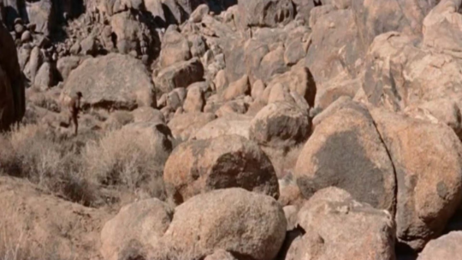
I walked around the trail they had. I liked this part of the stream. Obviously, it was a nice summer day. The area around was beautiful! However, I tried to imagine what it would have been like in the winter of 1846-47 with cold icy snow all around. As I often say, nature does not play by rules. The Donner Party did not have the comforts of life that those on vacation playing around the on streams, rivers, and lake have. It was truly survival of the fittest for them. This is something to be remembered as the world currently deals with COVID-19.

Admittedly,  I do not think the video clips I had to put together for a video were really that great. Again, it was that feeling of being underwhelmed at the state park. There was just not enough unique material to present. I thought and thought about this for the past few months. I thought I would tack them on to the end of the previous video. That did not seem right. There were other ideas, but I decided to use Microsoft Flight Simulator 2020 as a tool to show the area. Then add the few clips. So, this is sort of a experiment for this video. It is not the type of thing I expect everyone to think is really that great, but you cannot always hit it out of the park in every video.

Flying Over Donner (Youtube Video)

I think this will be the last blog of 2020. I decided the next adventure I was going to share will probably show up at the beginning of the new year. I have a bunch of things I want to say, and changes I am considering that will be announced at some point early in 2021. Until then please enjoy and make the best you can of the holidays this year!

Music from Incompech.com used is Beauty Flow and A Very Brady Special.

Saturday, December 19, 2020

The Historic Roller Pass Hike

 (GPS: N39 17.710 W120 19.195)

This was the hike I thought we were going to do in October, 2019. When we got there the icy snow was bad enough that we did not feel comfortable taking my sister-in-law. We decided to come back for this one in August, 2020. This time we were getting gas in Truckee and noticed a sign saying the road was closed! Great, we just drove a few hours to get denied a second time! 

We had an idea to get back on the freeway and come around to the trailhead from another way. Otherwise we would have to look for something else in the area to do. Fortunately, after about a ten to fifteen minute drive, we were able to get to the trailhead from the other side of historic Donner Pass. Somewhat relieved we headed up the trail.

 This is just up the trail and looking back at the road to Donner Pass. We drove up this way in October, 2019. This time they were doing some work on it. If you look closely you can see they blocked off the road. I was glad I took some pictures and video from that area in October which you can see in the October 31st blog. I was not able to access it this time around.

The picture above is the historic Donner Pass. This was the pass the Donner Party was attempting to get up to in the winter of 1846-47. Not shown is Donner Lake which is down below on what would be the right side of the picture. They stayed at the lake, and the goal was to get up to this point from there.

This is all am going to say about Donner Pass because we turned around and started hiking the trail away from Donner. There were two other passes discovered during that time period that were relatively easier if you knew were they were. One would be Roller Pass and the other Coldstream Pass. For this hike we went to Roller Pass.

This is the type of terrain we encountered on the way to Roller Pass. Honestly, this was a pretty easy up and back hike that only took about two hours. Very gentle uphill, quiet, and relaxing. I would consider this more in line with well maintained trails of Yosemite or something on the Western Sierra. We were in the mood for something easy so this was good one to do.

This is Roller Pass. The picture does not completely do it justice, but there is a big incline here. You have to imagine trying to take your wagons up this way during the late 1840's. They estimated a little less than 10,000 people came through this way during that period. The following sign might be helpful:
If you want to read the details you should be able to click the picture to get the bigger version. 

After spending some time checking out the pass we decided to go a little further. The following is where we ended up looking back:

Roller Pass is on the left side and you can see some of Donner Lake on the upper right part of the picture. We had the option of hiking up to Mt. Judah which is the high point you see. We just were not as motivated to do that. I am sure the views from there are great, but this was not like climbing a peak in the Eastern Sierra which are much higher. There is always another time for that if we ever get back this way. So, we were satisfied with getting to Roller Pass and a little beyond.

The Historical Roller Pass (Youtube Video)

Music from Incompech.com used is Beauty Flow, A Very Brady Special, Ancient Rite.

Sunday, November 22, 2020

Christmas Scammers! 'Tis The Season!

I have been working on my next project, but as we are in the holiday season I wanted to make a "public service announcement". I have always been annoyed with people that try to trick people in order to steal from them. What I am about to tell you happens all the time, but it becomes a lot more obvious to me during the holidays.

First, let me say this, I am really sick of the ads and pop-up ads that have flooded the internet. You cannot go anywhere online without being hit with all sorts of ads. I remember the early days of the internet before pop-ads showed up. I have learned that you just have to have some form of ad-block on your browsers because everything has gotten so far out of control on this. (Edit: as of Feb. 2021, I have found Ublock Origin to be pretty good as a ad-blocker.)

That is one thing, but the other thing is a lot of these websites and social media (Facebook, Instagram, etc.) are allowing scammers to advertise on their sites. You see these cheap deals that beat all the other prices around. Why is that? Probably because they are bootleg operations from some overseas country. IF you get whatever you purchased you then find out it was a cheap knock off of what they advertised.

On social media they have a tendency to keep all positive comments up about their advertisement, but if negative comments come up pointing out the scam then those get deleted. The new thing that irritates me is people blindly assuming what they purchased at Target, Walmart, Best Buy, etc. is the same thing they see in one of these ads. This is where the mindless commenting comes up that social media encourages. So, people will come on these advertisements saying, "Oh, I love this! I just got one from Walmart last week!" Great, you just encouraged the scam!?!?!?! The question of course is, "Are you getting the identical product that is made from the same company?" That type of question is never asked or gets deleted because it would reveal the scam.

I cannot remember if I mentioned it on here, but I got tricked about two years ago on Instagram. I saw something my mother would have liked. I purchased it, but afterwords I started spending more time looking up prices. I saw what I got was an overpriced rip off. I sent an e-mail off telling them I wanted to cancel. They waited four days, until about 10 minutes after it was shipped, to tell me it was too late to cancel. I got the credit card company to cancel, and when the package arrived I told the mailman to send it back. I think the package just got thrown out right away at the post office since they were not able to return it. 

So, please be careful purchasing from websites or ads that DO NOT HAVE A GOOD REPUTATION YOU CAN VERIFY! Check around, do some searches, and ask others if you are not sure. 

Another topic about scammers are the ones that use the phone. It is a big topic, but let me suggest you and any elderly people you know watch the following:

Spying on the Scammers Series (Youtube)

Jim Browing is really good at exposing these types of people. Another guy I like to watch is Kitboga who loves wasting the scammer's time by turning it into a role-playing game.

 (EDIT: Here is a nice USA Today article about what I have just mentioned)

Saturday, October 31, 2020

Escaping the Silent Donner Tunnels

Happy Halloween!

 If you have not, please check out the previous blog before this one since this is the conclusion of this two part hike. So when I left off we were in a pitch black tunnel. I shot a few pictures with my camera that has a flash that showed where we were:
Somewhere I think we remembered on the way back we had cell phones that might be helpful like the Phial of Galadriel if we truly needed light. It took a few minutes, but finally I saw a tiny dot ahead that started to get bigger. Btw, in the video I did not show the pitch black part because I think it would have been ridiculous. It would have been like just showing a black screen because you cannot see anything. I show a few seconds of where the light at the end of the tunnel was bigger. In any case, we came out of the tunnel, looked ahead, and down to our left we saw Donner Lake. I show that in the video. The following picture was a bit earlier before the final tunnel we came out of. I just wanted to show how the cloud was over the lake.


 The following is looking back at the long tunnel we went through.

At this point I think it is a good idea to give a simple explanation as to what was going on here. If you were not sure what this was, these were train tunnels used with the transcontinental railroad built by Chinese workers and finished in 1867. It was used from 1868 to 1993. Without tunnels it would have been very difficult to maintain a railroad over the Sierra during the winter months. So, this tunnel was created.

When we left we drove down to an open area that gave us good views of the area. Here you can clearly see the icy snow on the mountain as well as the train tunnel. Down below to our left was the following:

 The cloud over Donner Lake you saw earlier was gone. We went home after this, but I should say a few extra things here because I am not done with Donner Pass just yet.

This hike was done during last October, 2019. We knew we wanted to come back to do the other hike we originally thought we were going to do. Our goal was to do that and visit the Donner State Memorial Park during the summer of 2020. I ended up regretting not going to the Memorial Park during this October trip. I will explain why whenever I get around to putting those blogs together. Hopefully, by the end of the year. Until then...

The Silent Donner Tunnels (Youtube Video)

The music from Incompetech.com used in the video is called Symmetry and Man Down, and Crypto.

Friday, October 30, 2020

The Silent Donner Tunnels

Happy Halloween!

 (GPS:N39 19.000 W120 19.560) 

About a year ago my sister-in-law wanted to do a hike that my brother and I had never done before. So much of what I am about to show you I had no prior knowledge of before going. Originally, we were supposed to do a hike at Donner Pass. I was all for that because I was always curious about the history of Donner Pass and tragic story of the Donner Party. This area is a little out of the way from where I normally hang out in the Eastern Sierra. After leaving home in the dark, a couple of hours later we reached the following sign and parked nearby.

The drive thru Truckee had been rather foggy that morning. We noticed the mountain side was full of icy snow. I was slightly concerned about this since I had not really prepared for a snow hike and really had no idea where this hike would take us. As we started the first five minutes of the hike going up hill I felt pretty good, but my brother told me to stop since he was a bit concerned about my sister-in-law on this one. The icy snow did seem like it would get worse. In the past, when we have hiked through icy snowed in areas, the concern is not always right away during the early morning hours when the ice is solid. It is when the sun comes out and the day warms up that the ice melts. If one is not equipped and prepared that can be a bad thing when you a returning. So instead of being Donner Party part 2 we came back to the trailhead. My sister-in-law got out her cell phone and tried to come up with plan B for the day. There was something nearby...
This is part of the Historic Donner Pass Trail. I thought we were attempting to do that with the other trail we were on. Again, this is not a hike I planned out like I have done for most of the hikes on this blog. I usually have some idea of what to expect, but this was completely going without much knowledge of what I was getting into. So, the idea was, "Let's explore these tunnels!" Not too far in the first major tunnel we had an interesting ray of light.
That was interesting because we had been watching the Peter Jackson directed The Hobbit and The Lord of the Rings movies during this time. This mountain and these tunnels definitely gave me the feeling I was near Erebor, the Misty Mountains, and the Mines of Moria all at the same time. I noticed there was a lot of graffiti as we headed in. The tunnels appeared to be quite old, but not used anymore.
As we went along the tunnels they were quite long. At moments the light from the outside was coming in through the slits the tunnels had, but was getting darker the more we went. We did not have flashlights, but I did have my camera with a flash so I took the above picture.
The one concern I did have was the idea that zombies, Gollum, or some other random person might show up! Sure enough, the only person we encountered during this time was coming back! Fortunately, that was in a area that was not too dark. I did see him and say "Hi!" before things got too creepy! Right after that the tunnel became pitch black. We were actually moving kind of slow during this point. It was not too bad. I could not see anything, but did walk through some water. 

I will finish this up in the next blog. Stay connected! 

The Silent Donner Tunnels (Youtube Video)

 The music from Incompetech.com used in the video is called Symmetry, Man Down, and Crypto.

Wednesday, April 01, 2020

I Wanna Be A Cowboy

So I was part of a cattle drive back in October. Yep, always wanted to do the Red Dead Redemption thing as seen in westerns.

Checking today's date! Oh, I guess I better tell you what was really going on here...

Well, kind of, sort of...I was told to bang the side of my vehicle if the cattle were just standing in front of me to keep them moving. We were just passing through, and I think they were just transferring the cattle to a different field. However, I do know the cattle in this area do go on a traditional cattle drive much further away later in the fall.

In any case, hope you area all holding up over the stay at home order with the COVID-19 . I'm following all the rules the authorities are laying out for us, BUT I am a little skeptical of what is being reported and how big the threat is. There is something a little "Phantom Menace" about all of this. If I say anything more about this I will wait until this is over.

Sunday, March 01, 2020

A Joel McCrea Shootout Part 3 (The Alabama Hills Series)

(GPS: N36 35.995 W118 07.490)
(AKA The Shark Fin Hike Part 3)

Alright, the finale of this location and the hike. I think of all of the locations and hikes I have shown over the years, this is the one I have ended up delaying the most for many reasons. It is a little out of the way compared to other spots in the Alabama Hills I like to go to. Do not get me wrong, you can drive pretty close to this and do a short walk to it.. However, I tend to like to park in one spot in the Alabama Hills and hike around. I will get to some of the issues I had in editing the video together, but let me continue where I left off in the last blog.

After the major cowboy versus cowboy battle, our main bad guy flees off into the rocks. Joel McCrea chases him down. He hides behind these rocks for cover.
 This shot was interesting to me in that the camera man had to be down really low. Possibly, he was on he belly holding the camera up to get this shot. I did not do that, but I did have to lean over in a very painful way. It was a difficult shot to get because of that issue. I am glad I got it though and is one of my favorite pictures of the bunch.
 After exchanging some gun shots back and forth. Both of our characters try to sneak up on each other here. Our bad guy sneaks up only to find Joel is not there anymore. Where could he be?
 I mention this in the video that part of the trick is to make the viewer think this area is big enough so that a lot of sneaking around can be done. While I was there I did not think that really could be done. IMO, you can not really get away with sneaking around without the other person knowing like they did in the movie.
 In the movie, Joel sneaks around and clearly has the advantage. Our bad guy knows he is caught, but Joel sets up the honorable gunfight duel with both guys putting their guns away. Joel basically says, "Sure you want to do this?" Of course, our bad guy draws first, but is beaten in the draw. Fortunately for him, Joel shot him in the arm and he will live.
 This is the perspective looking at Joel. They go back and forth here between the two creating tension in the movie.

That covers the main parts I wanted to do for this blog. I want you to see the video since I spent much more time on it than any other video I have done. Let me explain the process for this one:

So some years ago I scouted the area, took pictures and video, went back a few times, dealt with some bad windy weather on one trip, did some pre-editing on the computer, did not like some of the footage, figured out how I would deal with the sun, went back, and finally got the footage I liked. A few months later I started working on the project on Sony Vegas. I put it all together with tons of cuts and edits to emulate how it was done in Cattle Empire. Then tried to render the footage and all sorts of weird things started to happen. It would not fully render the video and stop. It would put "ghost" images into the footage that never made sense to me. I tried it on an alternative computer that is much faster, and the same thing happened. After me staying up almost twenty four hours without sleep because the thing was driving me crazy, I figured out how to put it into parts that would work for a final render.

I hope you enjoy it. Bonus points for you that watch it multiple times to stop and match up every single rock used in the movie. LOL!

A Joel McCrea Shootout (Youtube Video)

The music used from Incompetech.com is called Stay the Course and Bittersweet.

Saturday, February 29, 2020

A Joel McCrea Shootout Part 2 (The Alabama Hills Series)

(GPS: N36 35.995 W118 07.490)
(AKA The Shark Fin Hike Part 3)

Happy Leap Year Day! Lol!

This is the second part the Joel McCrea Shootout. Again, this gets a little confusing because I need three blogs to do this location, yet all three are the final part of the Shark Fin Hike series. If it does not make sense to you, then do not worry about it too much and just follow along.

In Cattle Empire, the bad cowboys attack Joel McCrea's cowboys. During this scene there are a lot of quick edits back and forth. I cut out all of that here, but I do show some of that in the video. Eventually, Joel and company get the upper hand when the group that Joel sent to set up the flanking attack charges. Which leads to this shot as the bad guys basically give up.
I mention this in the video that it appears that they shot this movie in the afternoon. I typically like to get to the Alabama Hills early in the morning. In this area, that is an issue because the sun hovers right into the direction of the camera when I am there in the morning. I learned my lesson on this, and the last time time I was there made sure to bring an umbrella to block some of the sunlight.  
 In the movie, our main villain does not give up and runs off into the following group of rocks.
 This is where the fun really starts to begin. Hopefully, you can match up some of the main rocks here with the above picture.
 At the start of this our main bad guy hides behind the following rock and takes a few shots at Joel McCrea
 In the following picture we have the perspective of Joel McCrea looking at the rock our bad guy is hiding behind.
Tomorrow I will wrap this up by showing Joel McCrea's perspective, where they try to outwit each other, and the final gunfight position.

A Joel McCrea Shootout (Youtube Video)

The music used from Incompetech.com is called Stay the Course and Bittersweet.

Friday, February 28, 2020

A Joel McCrea Shootout Part 1 (The Alabama Hills Series)

(GPS: N36 35.995 W118 07.490)

(AKA The Shark Fin Hike Part 3)

This begins the climax of what I have been building to in the past few blogs. This is the third and ending part of The Shark Fin Hike series, but this particular location itself will take a few blogs for me to present everything. I'll probably have to re-edit these as I try to finish it up.

Over a decade ago I was watching the movie Cattle Empire (1958) with Joel McCrea. I did not really care for this movie very much. A lot of westerns use a variations of the same stories over and over. How they are executed though is the key. In the case of Cattle Empire it is the type of movie I would watch once because of Joel McCrea, but never watch again. However, they did one thing at the end for the climax of the movie that I really liked.

I told myself at the time that I would have to hunt down the location and do something for it on this blog. It was not a priority compared to other things I wanted to get done. I'll get to some of the obstacles in the next blog or two as to why it took me so long. Let us get started on the actual location.
 The movie starts on a town set, but it gradually has outdoor scenes for the cattle drive scenes. At the end, two opposing groups of cowboys fight it out here. The above rock formation was taken from the Cattle Empire movie. It has been seen in lots of movies in the background, but in this movie it is featured.
The bad guys show up on both sides of the above rock formation. Before that happens, Joel McCrea and his cowboys head to the following gully.
 This is our gully that they come to.
 When they arrive Joel's cowboys hide behind it. He eventually sends part of his cowboys off further to the west to set up what is a flanking attack from the side.
 This is another shot of the gully that will give you you some idea of how they used it here.
 I'll continue this in the next blog.

A Joel McCrea Shootout (Youtube Video)

The music used from Incompetech.com is called Stay the Course and Bittersweet.

Sunday, February 23, 2020

The Tom Mix Hut(s) (The Alabama Hills Series)

(GPS: N36°35.790 W118°07.700)

(AKA The Shark Fin Hike Part 2)

So after spending some time at the Shark Fin rocks all one needs to do is continue on the trail past them to get to the next destination. When I did this hike on my own I could not remember how much further I needed to go since I had not been here in over a decade. After pulling around the corner of some rocks I came to this spot.
The following is a screenshot from the Tom Mix movie Riders of the Purple Sage made in 1925. In the movie Tom Mix climbs a mountainside and comes to these habitation huts.
My angle for this shot is a little off here, since I should be moving over to the left some to line it up when comparing it to the following picture:
However, if my memory is correct, I was using the following picture from a different scene that lines up better.

 I think that works:
In the movie, they have Tom Mix look over into a shot of Yosemite which is great in the movie, but nothing you would see from here. Remember he is supposed to be on an elevated mountain here that he climbed to.

As I state in the video, I always enjoy looking up the old silent film sites just to see if there are any traces of what once was. In this case, there is a lot! That I am thankful for. Eventually, I will show a site where I can tell you it is the right spot, but there is nothing left. That is typical for many silent movie locations.

The Tom Mix Hut (The Shark Fin Hike Part 2) Youtube Video

The music from Incompetch.com is called Mister Exposition and Frogs Legs Rag.

Monday, February 17, 2020

The Shark Fin (The Alabama Hills Series)

(GPS: N36 35.930 W118 07.090)

 (AKA The Shark Fin Hike Part I)

It begins! This is the first part in a three part series. This is a good series for a beginner to the Alabama Hills, or someone who also wants to check out some other areas a little off the beaten path.

I've had to delay this series for a bunch of reasons. The obvious one was what I was talking about in the blog of December 2019. However, one of the big reasons I have not had as many Alabama Hills blogs in recent years has to do with the fact that many more people are showing up there and hanging out in the areas I would make videos at. It is hard for me to do things if there are people or vehicles in the spots I am going to. This has happened a bunch of times to me after driving a few hours to a spot only to find it occupied. I was going to say something about this in this first video, but I thought it would take too long, and I would sound a little too irritated. It is a little more complicated than the way I just described it. I'm going to wait until I go back in the next few months, and see how the situation is before I say anymore on this.

The GPS coordinates take you to where you can park right off of movie road. It is a very obvious spot you get to right as you enter the Alabama Hills from Whitney Portal Road onto Movie Road. More than likely you will encounter some vehicles here because the Shark Fin is used for rock climbing. That is what most people know it for. I am going to emphasize the movie location part of it for this blog.
It is pretty obvious where to go here. The sign tells you to park here because you are not to take in vehicles any further. So you do have to get those feet moving.
I have encountered rock climbers on the Shark Fin once or twice. Not always though. In the most recent time they were there I just bypassed them, and came back at another time. It is pretty typical to see this rock formation in the background of movies. I mention a Buck Jones serial in the video, The Roaring West, make in the 1930's that has it in the background.
The one serial that had it was the Hi-Yo Silver movie you can find on dvd. It was originally The Lone Ranger serial from 1938. It is the same movie that has the ambush in what they call "Lone Ranger Canyon" in the Alabama Hills. Here the rangers ride into their secret cave.
Of course, there really is not a cave there.

The Shark Fin (The Shark Fin Hike Part 1) on Youtube.

Music taken from Incompetech.com that is used for the video is called Crowd Hammer.