Saturday, August 18, 2007

The Mt. Whitney Hike: The Final Push to the Summit (Part 4)

The interesting rock formations to the left of the trail go on for a while, but then disappear as you start to get close to the final ascent.
You can barely see it, but, the trail goes to one of those patches of snow below and then the final 10 minutes is just a zig-zag trail to the top. Somewhere around this point that I finally encountered two people using the trail and passed them up. They complained it was too cold. I agreed, but I had just enough clothes on and had put on some gloves that I was feeling great. Keep in mind that everyone, except for me, this early in the morning had been camping just below at Trail Camp so that would explain why they felt so cold. I had many hours of hiking to keep myself warm since I had come from the portal.
Guitar Lake:
A good shot of what those needles look like from the back side. The Paiutes had a story about a Hawk who plucked two of his feathers to capture and kill a bee that had cause much havok among other animals. These "little Whitney's" are the feathers.
This is looking back south and partly where I had just been. Muir peak is the high point in the picture and can be climbed as a side trip off the main trail...maybe next time.
The base of the mountain and the last 10 minutes of the hike.
It was at this point I said to myself, "it looks like I am actually going to pull this off". I saw the summit hut. I knew my long journey was coming to and end.
However, I decided I was not going to stop until I reached the plaque. Which is just a little further on the other side. When I reached the plaque I stopped, took a drink, and started taking pictures.
There were two people already on top at 8:30am in the morning. Three guys had stayed over night in the summit hut. As I was taking pictures more people came up and I saw a bunch heading up as I went down. The altitude really had no obvious effects on me at all during the whole trip. I never really did any altitude hikes the months going into the hike nor did I train for this at all this year. I do keep myself in okay shape by jogging and taking regular walks, but I felt I could do a lot better time wise if I do this again.

Friday, August 17, 2007

The Whitney Hike: The Sequoia Side (Part 3)

Of course, the other factor one should be concerned with on this hike is the weather. Another reason I did not want to do this hike late in the middle of summer is the chances of lightning and bad conditions are greater. On this day there was no clouds in the sky. A perfect day so that issue was completely out of the picture I guess it makes sense to say. A few weeks later that would be a different story with lightning strikes causing fires in nearby Independence on the 395 affecting the whole area with dark smoke. On to the hike, at this point over the pass you enter Sequoia National Park and can see "behind" Mt. Whitney to the Great Western Divide range which is the dividing point between the Eastern and Western Sierras.
Looking back down from where I came:
At this point I was sure I would make it, but the last 2.5 miles goes on a lot further than one would think. You descend a few hundred feet right away knowning this is going to be troublesome on the way back. Keep in mind it is about 11 miles to the top, but you have to go back those 11 miles. Any uphill on the way down is annoying. There are a few spots like that.
The trail is a good one here assuming you do not encounter snow/ice. Lots of interesting rock formations to look at part of the way there.
I think my favorite viewing part of the hike is the area known as the "windows". These are the areas between the needles or spikes to the south of Whitney; most pictures you see of Whitney they are to the left of it. What is cool and can be a bit scary is on some of these the trail is only a few feet wide on these spots. There are long drop offs on both sides. Check this out:
It does not look like it, but the above picture is like a bridge. As you cross it and look to the right you get this:
Thats a nice drop off. On some of these it would take a while to hit bottom. On the left of me you get this:
On the above picture you might hit those rocks a bit quicker, but the results are still the same on a drop. I had no problems with this area, as most people, but some get scared and I can only imagine what it must feel like if there is a giant gust of wind coming through the windows.
The above picture is of Hitchcock Lakes. This is on the Sequoia side. There are lots of interesting things to see on this side of the hike that one cannot see from below.

More to come...

The Whitney Hike: Switchbacks to Trail Crest (Part 2)

I started the dreaded 96+ switchbacks. I have read there were originally 99, but then some work was done and they were cut to 97 or 96. I never have figured out how many there actually are. The thing is the whole hike has switchbacks, but these are the main switchbacks everyone refers to that get you over the pass.
At the beginning they are very short, and you get up to 25 of them really quick. The 25th one was important because I knew I could get clean water from it on the way down. I took four bottles of Gatorade and one empty bottle to be filled here. Funny thing is I only used three bottles of Gatorade to get to the top. I was surprised about that. People say you need a lot more than what I had with me. For some reason on the way down I never really needed that much water. I was prepared, but never drank that fourth bottle of my trusty Gatorade. I filled up water twice though on the way down.
This was the dreaded area. Since I had never experienced this area I was concerned about it. The cable area is about 45 switchbacks in and is dangerous. Any slips through those cables and you die. Had this been a good snow season this would have been more difficult. One of the reasons I was confident in going this early in the summer was that you could pass through it without touching any snow/ice. The thing to keep in mind is during the early morning hours many of the switchbacks had some ice on them. So I was pretty careful, not only here, but on all of them.
Okay, I got by the part I was most concerned with. Now I was feeling pretty good for a few minutes. Then, my head tightened up a bit. I was thinking I was starting to feel the symptoms of altitude sickness. I had not been over 12,279 feet before. I was thinking it might start getting worse and I might get a headache. I had some advil to use, but never did. The switchbacks continued to get monotonous and longer. I then started having doubts I would make it. It seemed like about 80% of this trip I was not sure I would make it.
At this point I could see my final destination. If you look real close you can see the summit hut.
Looking back down you can see Consultation Lake.
Iceberg Lake in the furtherest one in the distance and is right below the summit of Whitney.
There were people in front of me that morning on the switchbacks. They seemed so far away. Then after all 96+ of them I saw the sign I was looking for.
Actually, you see the backside of it and have to get in front of it to see this side. But, once I reached Trail Crest I was feeling good now. Everything I had suffered during those morning hours in the dark was past me. Even though I still had a long 2.5 miles and about 1000 feet to go (with a 500 foot decline in there somewhere) I was pretty sure I was going to finish now. Most people turn around about this point during their first time. What I thought might be altitude sickness was nothing at all. My theory is that if you are feeling good at this point you WILL make it. It is just a matter of time.

To be continued...

Thursday, August 16, 2007

The Whitney Hike: Lone Pine Lake Area to Trail Camp (Part 1)

Okay, here is one I have been promising for a while. I have talked about 1/5 of this hike before. Anyone can hike to Lone Pine Lake without a permit, but beyond it you must have one of the precious permits. I am going to skip talking about the trailhead to Lone Pine Lake and just refer to the old entries:

Mt. Whitney Area 1
Mt. Whitney Area 2
Mt. Whitney Area 3

Originally I was going to do this hike later in the summer with my brother, but his work schedule made it impossible. I decided to do this hike by myself instead. Two things made it possible: 1)It is a drought year so there was very little snow on the treacherous parts of the main trail. 2)Many permits were available early in the summer. So even though I had two permits I had paid for via the lottery for the main trail I decided to take my chances and just go for a walk in.

I had to wait until 11 am the day before the hike to get a permit, but I did it. I then drove as quickly as possible to Whitney Portal. I had the famous burger at the store and just waited around for the next 13 hours or so. It was very warm even at the portal, and if someone were watching me they would think I was depressed. I was not very happy with the conditions. I could not get any rest due to the heat. By the time the sun went down I was laying in the back of my truck, but could not go to sleep. Too much anxiety over possible bears, people driving by, and the hike itself. At 1 am I decided to take off.

It took me an hour and half to get to Lone Pine Lake. My pack was more heavy than I expected, my flashlight was really not very bright, and I was going much slower than I thought. I realized my penlight was much brighter than the flashlight so I changed batteries!

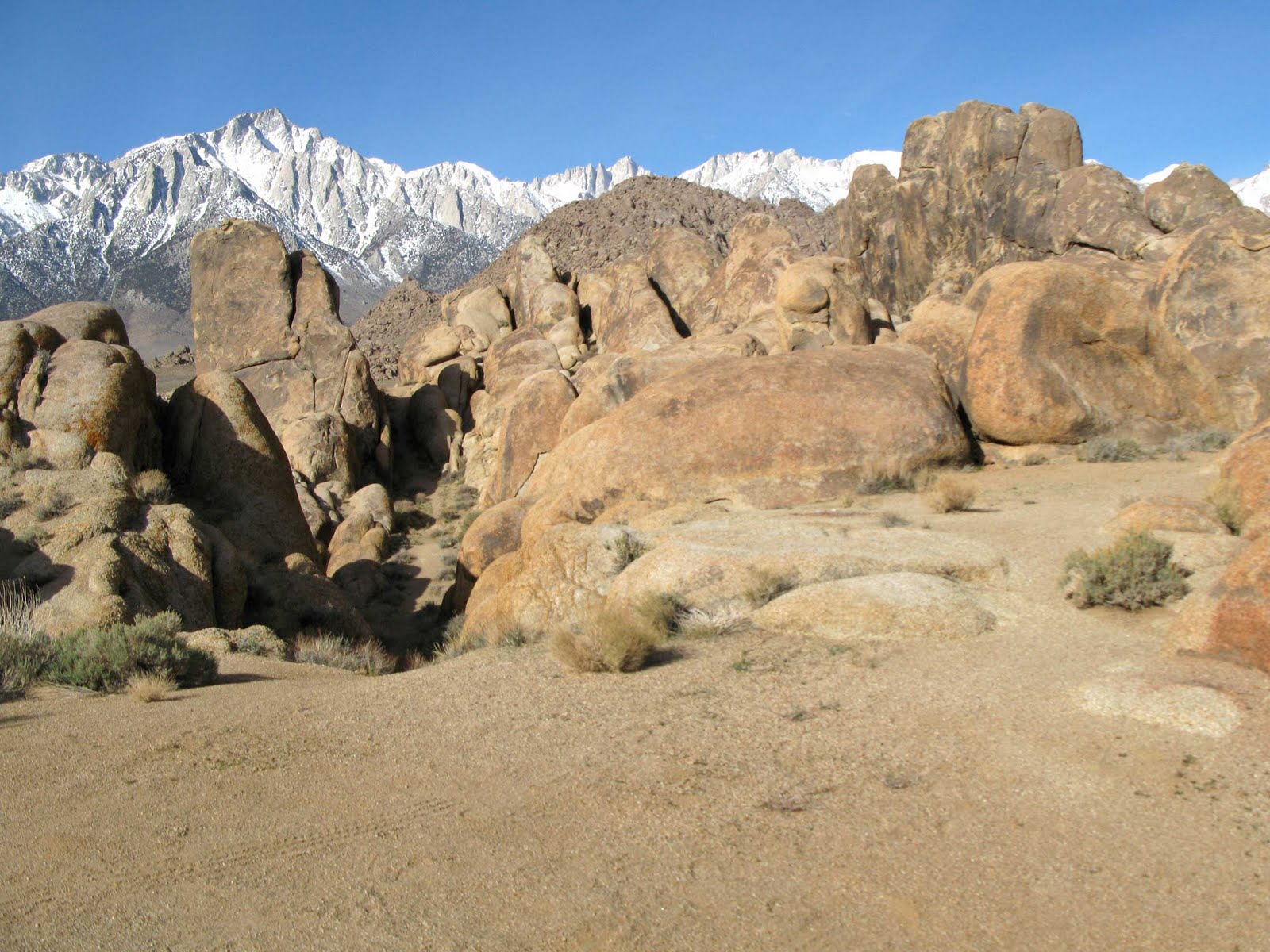
Okay, keep in mind that most of the following pictures were shot on the way down. I have to do this because most of these areas I crossed by in the dark, and I want to show how it the trail looks all the way to the summit. So, here is the point where you need the special wilderness permit:
By this time, my trekking pole started to collapse on me. It's around 2:30 am at this point. I figured I would have some problems like I do early on most hikes, but this was getting annoying. Keep in mind it was really dark, I was by myself, and wondering if I would encounter any other living creatures on the trail. I reached Bighorn Meadow. At this point I was concerned about getting off trail, but I really had nothing to worry about. Things flattened out for the next 15 minutes.
Of course, I did not see this on the way up, but it is a nice waterfall in the area that is probably really nice on a non-drought year. I liked it as it was.
Everyonce in a while I would look back like this. Futher up you can see all the lights down in Lone Pine. I saw a falling star as I continued up. This is looking back at Bighorn Meadow and one of the first places people often camp, Outpost Camp.
It was not too far after this that I accidentally crossed over some rocks and left the trail. The next thing I knew my flashlight was hitting some guys sleeping bag! OH NO! I said, very quietly, "Oh shoot, sorry!" I kept walking and was lost. I came back and the man asked me if he could help. He told me I crossed over the rocks and missed the switchback. I was really stunned. I went back and still was in the wrong direction.

I could not find the trail. At this point I was so miserable over the situation as it was that I was just about to turn back. Many thoughts went through my head. I can't tell you how close I was to saying, "Screw this, I need to go back home and get on with my life. I am fooling myself in trying to do this." I can only attribute the grace and mercy of God on this one. Somehow in my last attempt to find the trail I saw my mistake. It makes me sick thinking back on how I almost screwed this one up. Some other thoughts that I was thinking...if I turned around I don't think I would ever enjoy watching any of those movies with Mt. Whitney in the background...there are a bunch of elementary school kids that know me that knew I would be doing this hike. It would be like they were kicking me in the chest each time they asked how I did. Even though I found the trail here at around 3 am I still was not too confident I would make it, but I just told myself just keep going and see what it is like when the sun comes up. Here is how the beautiful Mirror Lake looks from above.
I kept going higher and higher. I was still going at a slow pace, but I felt my ability to follow the trail with my flashlight was a bit better. It isn't a hard trail to follow, but in the middle of the night anything can happen. I had seen pictures and videos of this trail before, but I did not recognize the following area. I wasn't sure if I was going the correct way, but I was on a good trail.
The next thing I knew things were getting a little lighter out, not sunlight, but it was not as dark. I could see the high wall of the canyon and then Consultation Lake on my left!
A few minutes after this I realized that I could shut my flashlight off and walk! It was around 5 am, the sun was not really out yet, but there was enough light. I had reached Trail Camp at this point! I started seeing people on each side of me on the trail in tents and sleeping bags. My spirits lifted a bit thinking I might actually pull this off after all! I had a funny feeling as I felt as if I was being shown a bunch of homeless people on each side of the trail. I have read people refer to this trail area as "the slums of the backcountry". It is not that bad, but it makes sense to me.
At this point I had gone 6 miles and a few thousand feet. With the sunlight coming out I was feeling pretty good, but I knew the worst was coming. Early in the morning I was looking back on the people. You have to look closely, but there are people here and some tents around.
At this point I had gone about 4 hours. Now I had to deal with what many consider the toughest part of the main trail: the 96+ switchbacks!

To be continued...

Wednesday, July 25, 2007

VASQUEZ ROCKS 3 (Wrap Up)

Tiburcio Vasquez, who this area is named after, was the bandit who used this area as one of his many hide outs. Apart from the main area there are some nice trails around to explore the many other features of this area. One can see why this would be a nice area to use as a hide out. From the last picture of my last entry, if one would just turn around they would see this:
One can see the 14 freeway in the background. It is interesting to note that the Pacific Crest Trail runs through the park. I went a bit further out of the well worn area for the next few.
I went down this one canyon not knowing what I would find. I saw this "face" in the distance:
I thought it might start talking to me, but it never did.
On the way back.
This wraps up my little series on Vasquez. It is a nice area to go to when the weather conditions are good. I am going to be out of town for a few weeks, but when I get back I will start my Mount Whitney hike series.

Monday, July 23, 2007

Vasquez Rocks 2 (Star Trek + Blazing Saddles)

Continuing from the last entry, all one has do is drive up the road to the other side. Then look back and you have the other side of the famous rock formation. To the Trekkers it is known as the arena Kirk fought the Gorn at:

To others, it is where Hedley Lamarr tells his evil minions to "do that voo-doo that you do so well!"
You can see the railroad they were building was not too far away either.
The following picture is much further into the park (south), but you can still see the main rocks in the distance.
Just last week I was watching Kevin Sorbo in Avenging Angel on the Hallmark Channel. There was a scene within the first 20 minutes of the movie where he had to deal out Justice to a baddie at the main rock formation. In the next entry I will wrap this up with some of the lesser explored areas along the hiking trail they have.

Saturday, July 21, 2007

Vasquez Rocks (The Army of Darkness)

(GPS: N34 29.245 W118 18.950)

Some time back I went to Corriganville, Iverson Ranch, and then ended up at Vasquez Rocks. Vasquez Rocks Natural Area Park is nice to go to if you want to get out of the urban Los Angeles area. Unfortunately, the day I went I wanted to beat the traffic so I went very early to these places. When I got to Vasquez it was only around 9-10am so the sun was not out in full yet. My pictures for this entry suffered because of the shadows. I could have done some photoshop work here, but decided it was not worth it. The pictures in this entry should do the job of showing the area though for those that have not been there.

The following picture is taken from the scene in the movie The Army of Darkness before Ash (Bruce Campbell) goes off into the woods and to the cemetery. It is where the old wise one tells him he must recite the lines "klatu verata nikto" before he grabs the book.
The sun had the absolute worst angle for this picture, but this will have to do. This is the main area that has been used many times in movies. Unlike other areas like this, you can actually drive your car right threw this road. You get to the other side, there is plenty of spaces to park, you can picnic, or you can hike further into other area.
This is just to the right of the above picture. I have seen some westerns go off in that direction.
I'll do another few entries on what lies on the other side. The other side is probably more familiar to most people.

Monday, June 25, 2007

San Diego (Some Like It Hot)

aka Hotel Del Coronado
I have been a little behind in some of entries I intended to write. I have some work I need to do with some peak hikes I intend to write up so I should be doing that as the summer goes on. Rather than throw out some more Alabama Hills pictures which I can always do and will continue to do, I thought I would show some stuff I took in San Diego some months back. I have always been a fan of California historical landmarks so lets start here:
I must admit that I am not the biggest fan of San Diego. The times I have gone there I have felt I did not have that much to do. When I was kid there was always the zoo and Sea World, but now I just do not enjoy it as much. There are some things I want to go back to in the next few months, but to me it always seems just like a big housing development. Hotel del Coronado is one of the few landmarks that is very powerful in San Diego. It was build in the mid-1880's. To spend time there you definitely have to have some money.
Many famous people have spent time here. It is well known from the Marilyn Monroe movie Some Like It Hot and a few others. It has an interesting structure to it.
The following picture, from what I remember, was a furnace. I can't remember anymore details to it.
Here is the famous Dragon Tree.
I have more from San Diego for some other time. I am a person who is not usually impressed with the more expensive aspects of locations and life. I am more into the natural beauty of the areas I have visited. However, there are some out there that might read this that like this sort of think so I thought I would include it. It does have some important historical value, as well as, movie history to it. Please refer to the following links for more information:

Thursday, May 24, 2007

Whatever Happened To Randolph Scott? (The Alabama Hills Series)

(GPS: N36 36.205 W118 06.895)

He's Riding Lonesome in the Alabama Hills. The following pictures from Comanche Station and Ride Lonesome are in an area known as Triple Camp. To get to this area you have to go through some of the other areas I have shown in previous entries: Lone Ranger Canyon, Gene Autry Rock, and you actually turn right when you approach Gary Cooper Rock. In both movies Randolph Scott heads up this narrow passage to his destination. Let's look at this scene from the beginning of Comanche Station:
You can compare the rocks with this picture.
The following picture shows that narrow passage one would take to get to the top. In Comanche Station they turn to the south which is left from the camera's point of view:
But, in Ride Lonesome. Randolph Scott captures James Best (aka the Sheriff of the old Dukes of Hazzard tv series) by turning north which is right from the camera's point of view:
This picture you can compare with the above two. The rock at the furthest to the right of the picture is the same one Randolph Scott is standing in front of just above. However, that is where he captured him.
This is one of my favorite areas in the Alabama Hills. Gary Cooper went through that narrow passage to in Lives of the Bengal Lancers. It is interesting to note though if you would go all the way to the other side it dead ends. Meaning, it looks like they can approach with their horses from that area, but in the real world there is a cliff there with rocks that would be impossible to cross with a horse.