(GPS: N37 57.340 W119 15.160)
Over the next few entries I will cover many different areas I did on that day I hiked a few places off the 120 highway. If I could pick two days of my most recent trip to the Eastern Sierra that I was the most at peace and happy this would be one along with the Snow Lake trip. I woke up early that morning just intending to go to Gardisky Lake and scout some areas near Saddleback Lake for a possible hike to Mt. Conness at a later time. Although I never did ever climb Conness this year due to my right foot being in a lot of pain during this trip; hiking on scree and snow terrains at an angle up a high elevation was not a good idea this year. I wanted to get home in one piece and knew I had some limitations this year. However, this hike ended up being a really great substitute looking back at what happened.
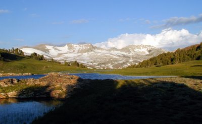 The picture above is just shows you what it was like that morning at around 7:00am. I am looking back at where I hiked in from. People say it takes about an hour from the trailhead, but even with my bad foot it only took me about 30 minutes. The climb on the trail is steep for people that are not in good shape. It was no problem for me really and was a good sign for me that I could do a lot more than I intended.
 The picture above is just shows you what it was like that morning at around 7:00am. I am looking back at where I hiked in from. People say it takes about an hour from the trailhead, but even with my bad foot it only took me about 30 minutes. The climb on the trail is steep for people that are not in good shape. It was no problem for me really and was a good sign for me that I could do a lot more than I intended.
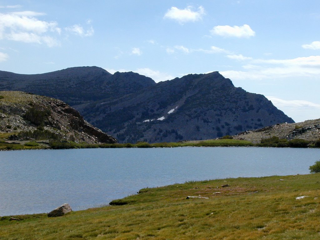 This is actually later in the day before I left the lake. I thought I would show these than the shady morning shots. At the other end of the lake the water drops off the edge forming a waterfall that goes down pretty far into the canyon.
 This is more of the same direction. This lake did look like a good lake to hike and fish at. It was a good size for that.
 The picture above is looking up at Tioga Peak. I looked at it and thought, "Hmm, maybe I should just go and see what I think." I started up it and all it is is granite rocks. It ended up taken me about an hour from the lake. I started out thinking I would not make it, but as I kept going I realized I just needed to go a little further and further. Next thing I knew I reached the summit. It is a relatively easy peak hike. Most peak hikes with good views taken me hours to do. This one was a total of 1 1/2 hours of total hiking time from the trailhead. The views are really good looking into Yosemite. Looking back east to the Mono Lake area was not that good so most everything I have is shot from the north, south, and west directions. Here are a few examples until the next entry:
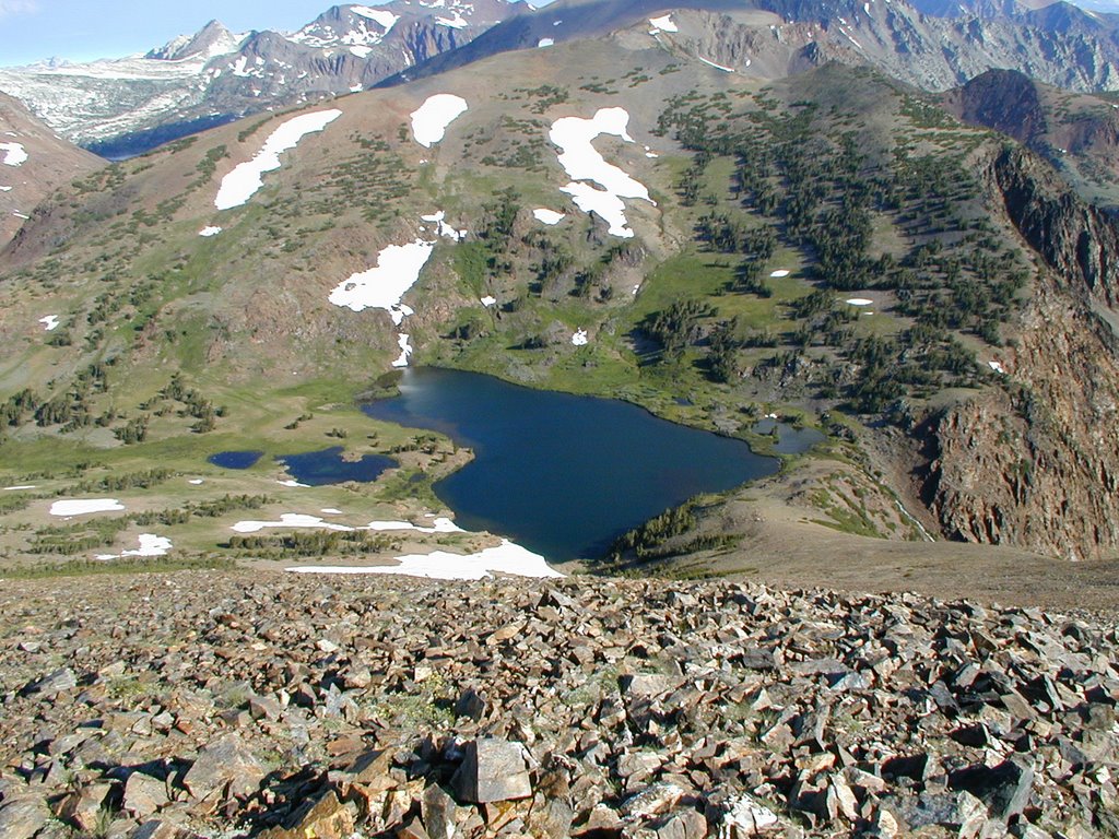 This is looking back down at Gardisky Lake from the top. Saddlebag Lake is to the high left of the picture.
 This is a zoomed in shot of Gardisky Lake.
 You can see the drainage of the lake over into a waterfall.
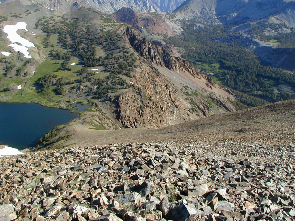 You can see the water drains into the Canyon. There is obviously a lot one could investigate from this lake on top of the other side.