Happy Thanksgiving!
The next two blog entries deal with a Yosemite hike I did a few years ago in October. Why have I waited on this one? Well, I meant to do another hike along with it, but due to fires and other issues over the past few years I never got around to it. So, I am tired of waiting so here we go.
For this hike I am shifting to the very end of it first. I will show the early morning part of the hike in the next blog. For now, I will just say that this hike is started on the eastern side of the entrance to Yosemite. You literally enter Yosemite and then just park beyond the entrance to Yosemite to reach the Gaylor Lakes trailhead.
After going up some switchbacks for about five hundred feet, then descended about the same amount of feet, one encounters the first of the Gaylor lakes, and then one heads more in a north-eastern direction to get too Upper Gaylor Lake. Then one follows the trail up to encounter the remains of this:
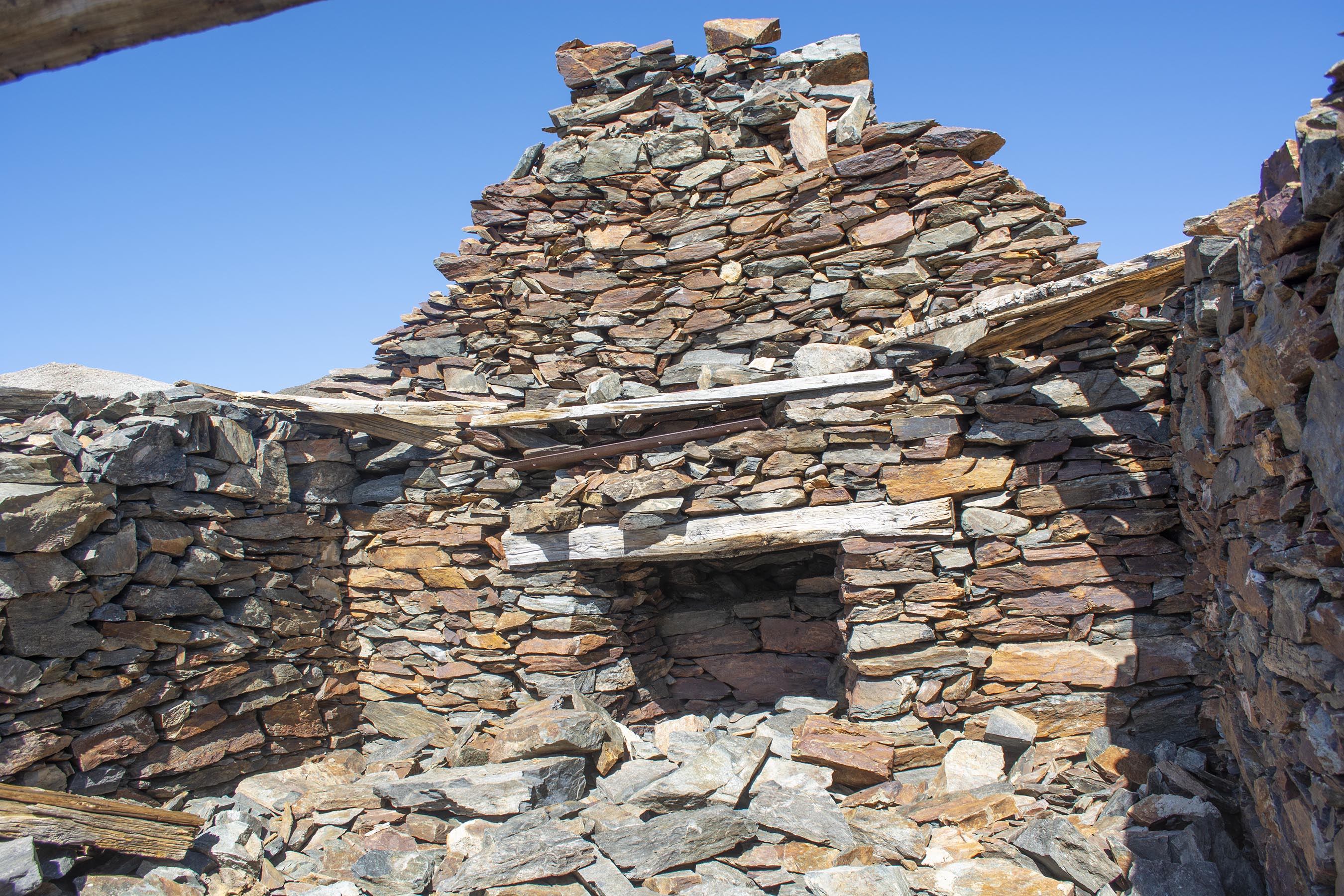
This is known as the Great Sierra Cabin on Tioga Hill. Another look of the cabin. There were miners wandering around this area making claims as early as 1860. It was a shepherd, William Brusky, from Sonora that ran into a claim from 1860 during the year of 1874. He worked on the claim until he found a promising vein in 1875. A few years later the Tioga Mining District was formed, and people scrambled to the area.
Inside the cabin I looked at where the fireplace would have been. There were big plans to turn this whole area into a city: Dana City. At some point they planned to make a tunnel that would go from this side to the east to Bennettville. I showed some pictures way back of the mining tunnel they started over there in those 2006 blog entries. Inside the cabin I framed Mt. Gaylor in the background. This is the view a miner would have had back when it was used. This is actually a common picture I have seen done by others that visit here. Most people that come here take this type of picture out the window. It is interesting to see what time of the year they show. I have seen some fun winter snow pictures here.
Stepping a few paces backwards I took another picture. See the snow/ice inside? I am going to recommend a book at the bottom that has some nice pictures of this cabin when it was still practically covered and complete.
Beyond the cabin heading more to the north-east I encountered a few mining holes. Please note that these holes are dangerous to get to close to. One can slip or the ground might cave in so that you would fall down into the holes. You can get trapped in them with no one around. Also, they did appear very cold.
Looking in the mine.
Not too far away I ran across some old mining equipment. Some of it is scattered around.
The community increased, a road was built to get from Sonora to here, and machinery was brought in to Bennettville from over the other side in the east. Yet, it was finally determined that while the mines were relatively good, the remote location, high freight rates, harsh weather, and other issues made it unprofitable. So, the tunnel remains in Bennettville were stopped. Both Bennettville and what was meant to be "Dana City" were abandoned.
In the next blog I will show some of my hike up Gaylor Peak that can be seen out the "window" in the above pictures. It looks like a pretty mountain hike dramatic doesn't it? Stay tuned...
While you can find some good information online doing some searches about the cabin, Tioga Hill, and "Dana City," I found that the book Yosemite's Tioga Country: A History and Appreciation by Gene Rose very good. It has a chapter that goes into much more detail that what I described here. Amazon has it much cheaper than I paid for it here.