Tuesday, December 31, 2019

2019 was a Rough Year! (In Memory of Mom)

I hope you are having a great holiday season. It has a been a long time since I have done something for this blog. I owe some of you that have e-mailed me over the past year an apology which I will get to. Seeing how this is the last day of the year I have been reflecting on what happened this year. 

1)What happened this year?

This year was kind of a disaster. When I began the year I made a Youtube video explaining all the things I intended to do. There was really only one thing that would prevent me for doing more videos, showing pictures, and doing more blogs on here.

At the end of last year, my mother had just passed her driving test when she started to complain about something hurting in her right arm. It never improved over the holidays. Took her to the doctor at the beginning of the year and was told a few things.

Thinking things would get better I started a few new blogs during the middle of January. It was within a few days of that we had to take her to the hospital. We got the news she was not doing too good. So, long story short I took care of her for the next five plus months until she took her last breath.

Both my mother and father were really great to me. My mom was just awesome. Always great to talk to and encouraging. A lot of my soul got ripped out during all of this because I realized just how much I was dependent on the well being of my mother going back as far as I remember. So, at some points during the next year I will probably say things on video and in the blog just as a "shout out" to my mother's soul and memory.

My Apologies! A bunch of you e-mailed me this year. I would say a good 95% of the e-mails I did not respond to. Nothing personal to you, but if you read the above I had my hands full and in some ways still will for a while. I just was not that motivated. So, if you see this I am sorry and please write me again in 2020 if you wanted a response. I'll try to be better about this.

I pretty much forced myself to do those last blogs back in March, but I really was not that inspired in those. I am still not really all that inspired, but I do have some items I want to share at some point this upcoming year.

2)Fall Colors?

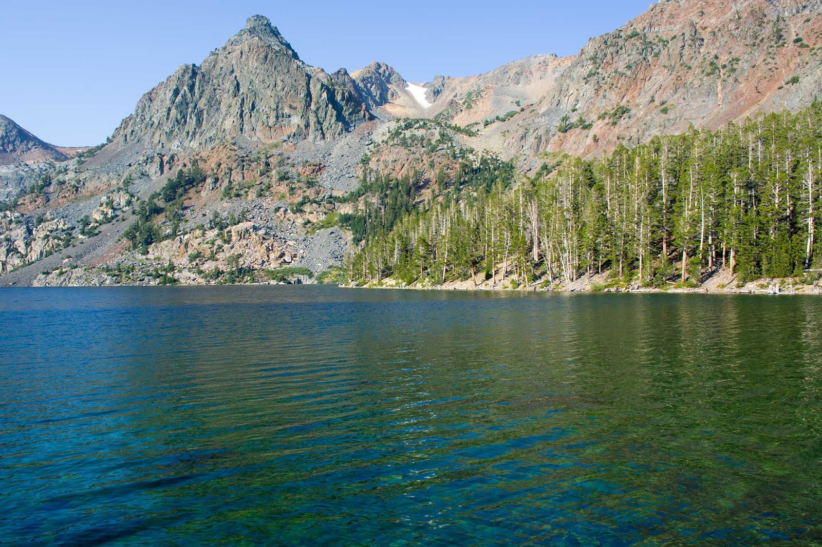
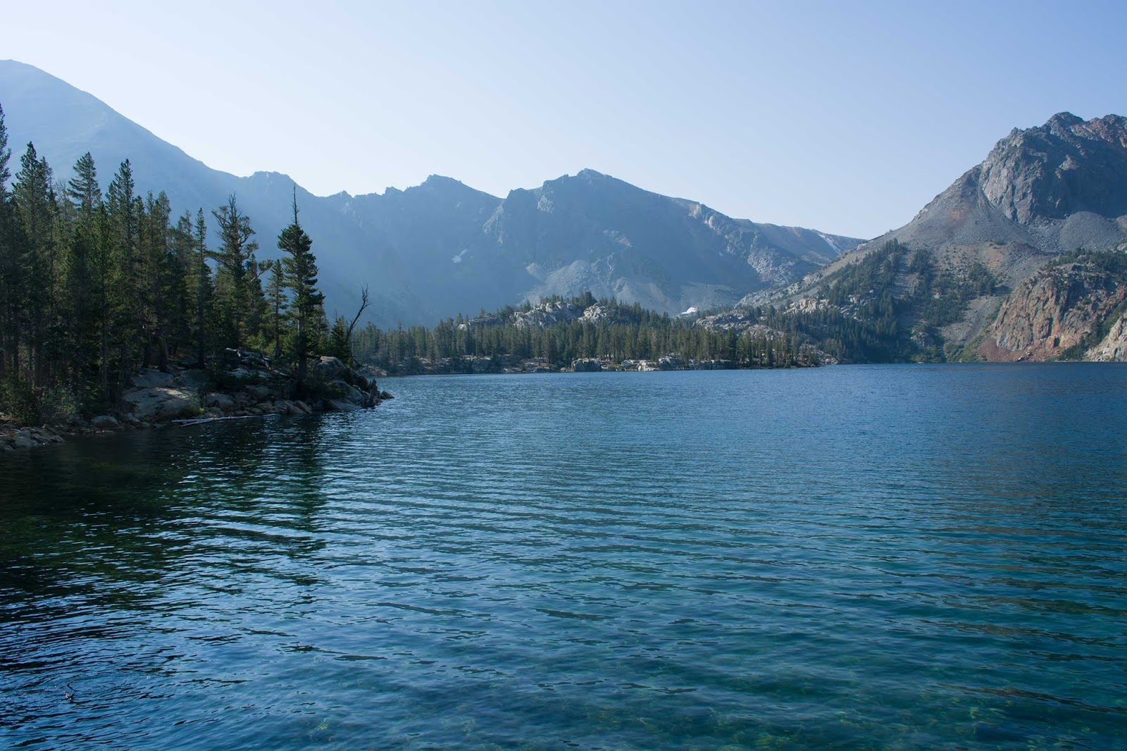
Last year I did not get to go. This year the Eastern Sierra fall colors were just not as good as other years. The timing of the colors was a little off. On most years you have a window of opportunity in some areas of about two weeks. I'm not sure if it had to do with excess snow and water from the winter, the weather, or just some other factor. The time I was there I could see the colors continue to change over the week, but it was a bit irregular. Some leaves stayed green, others were turning gold. This was one of the best areas I experienced at the time. I was at the June Lake Loop at one point right before I left. It had those irregular patches of green and some yellow, but nothing worth showing. I thought as I left it would be another week, but even then lots of leaves had fallen.


I'll have some more to say very soon in 2020. Happy New Year!

Saturday, March 30, 2019

Hike the High Country: The Green Creek Trail (to Summit Lake)

(GPS: N38 03.060 W119 19.180)

Time to wrap this one up. After the Hoover Lakes we continued up the trail back and forth. Eventually we ran into this worn down sign that splits the trail:

If we wanted to hike back up to Virginia Lakes we would take the trail left. It is a serious climb back in that direction if someone has ideas of doing that. Our goal was Summit Lake so off we went straight ahead.

There is actually a nice little meadow here that the water that falls from both the Virginia Lakes trail direction and Summit Lake that drains into all the previous lakes I have shown. Unfortunately, I did not get any good pictures or videos of this area. Have you have seen the Miner's tale ("All Gold Canyon") in The Ballad of Buster Scruggs anthology movie? I highly recommend the movie, but it really reminded me of this area along with a few others I have been to when I saw it.

In any case, we dipped down into the meadow with a crossfire of all the streams coming in. Then we hiked up the trail's final ascent to the lake. There was the destination I had both seen from a distance on the trail from Virginia Lakes and on maps over a few decades. Summit Lake!
My brother and I walked up to the lake and remarked on the beauty if it. At this point the clouds kicked in giving the area an overcast look to it. The smoke was not too bad here. I mentioned how I would like to be here in February/March just to see what it was like. My brother just said everything would be only white. Yeah, with this years snowfall it is probably just a winter wonderland of cold snow and ice.
I decided to walk around the lake for a few reasons. One I just wanted to see what the other side of the lake was like.
Glad that is not a volcano! Lol!
I reached the other side and looked back.

I show it in the video, but I walked a little further because I wanted to say that I entered Yosemite from this direction. Yes, the border of Yosemite is at the end of this lake. There is a sign and marker showing that it is the border.

The interesting thing about this hike is I mentioned that the clouds were slowing moving in to make it more overcast. As we headed back it continued to be like this until it started to get really dark. Then about the time I reached Green Lake the rain drops were coming down.

Keep in mind firefighters were still dealing with fires in Yosemite and other areas. I would say about the time I was near the final twenty minutes of the hike back to the truck it just started pouring. I was trying to keep my cameras dry in my backpack. I waited under a tree for about ten minutes hoping that the rain would pass. I got tired of waiting and raced back to the truck where my brother was waiting.

Once we started driving away and got closer to HWY 395 the rain stopped. If only the rain that was there would have hit those fire spots. In any case, a few days later I think the worst was over with the fires and they were in complete control.

Hike the High Country: The Green Creek Trail (Youtube)

Overall, a fun hike. One doesn't need to go all the way to Summit Lake and back in a day to enjoy it. I wouldn't mind starting at Virginia Lakes, then descending to Summit Lake, and then coming out at the Green Creek Trail head as a day hike. It would take some coordinating with a few cars, but can be done.

Music used from Incompetech is called Vulcan and For Originz.

Friday, March 29, 2019

Hike the High Country: The Green Creek Trail (to Hoover Lakes)

(GPS: N38 03.270 W119 17.470)

Continuing from the last blog, we followed the trail and eventually were looking over another lake. This was Gilman Lake. While we could have descended down to it we decided to stay on the trail and keep going. Somewhere here we had to cross over the stream that was running down to it. The following is past that stream and looking back on Gilman lake:
Not sure where we were going, but the trail kept switch backing and moving us a little higher.
Mysteriously, things started to get a little more rocky. Then this lake showed up! This is the first of the two Hoover Lakes. I had seen these lakes before up high on the trail that starts at Virginia Lakes. I was looking down on them and saw a few people hiking along. So it was great to finally see these lakes up close.
This is still the first Hoover Lake. I'm looking back at where I came from.
I turned around. Walked around the now rocky trail that went along the other side of Hoover Lakes. This is looking at the second Hoover lake and in the direction I would be going:

This is looking back at the Hoover lakes:

It was somewhere near the end of the Hoover Lake #2 that I found my brother looking at his cell phone. I was wondering if he was trying to get reception, but he told me that he was just looking at the gps map function. He then told me that it was not really that far to Summit Lake. My response was, "Cool! Then lets do it!"

I'll conclude this in the next blog about Summit Lake and the end of the hike.

Thursday, March 28, 2019

Hike the High Country: The Green Creek Trail (To East Lake)


(GPS: N38 06.440 W119 16.310)

This was another hike I did last summer. I had been on this trail a few times before, but it was always too early in the season, and I was stopped by snow each time. This time I did it in August, and I went much further that most people would go for a single day hike. Usually, to get that far back into the high country you want to backpack and spend the night. There was actually a lot more to this day than I can show in pictures and video, but I will try.

This wasn't my first choice hike, but due to the fire and smoke conditions it was another good alternative. I had seen the route on maps for years. In fact, I had seen the final destination from a far a few times. We will get to that.

The drive in on the dirt road takes a while, but eventually one ends up near the gps points above. With that my brother and I took the trail. The first thirty minutes or so is passing the camping area and then the trail combines with a driving road. Somewhere during the first hour I could hear a bear groaning just off the trail to my right. My brother, who was a few hundred feet ahead of me, verified that he heard the same thing that morning. It was actually kind of creepy. I had experienced that once before on a Thanksgiving Day in the back country. I've talked about black bears before on here, but you just wonder what could be lying around a corner ready to ambush.

So, about an hour and half into the hike we encountered Green Lake:
 I had been to Green Lake once before. It was here I had to turn around because the snow was just too much on a July 4th weekend years back. Before you get here there is a split in the trail. If you go to the right side of the trail you would head to West Lake. I think West Lake is where the falls are coming down from in the background. If I can ever get back there then I will go to West Lake, but for for what we intended to do we stayed on the trail that was heading left.

After we took a few moments at Green Lake we had to look for the trail to our next destination. We were not quite sure which way to go here, but we eventually decided to follow the switch backing trail. We crossed a few streams. Within about another twenty to thirty minutes it flattened out for us.
 Not too long after that we started to see some people around East Lake. Most of the people we saw that day were camping around this lake.
 It was a beautiful lake. The following three pictures are the best I can do to pan around the lake since I could not capture the lake in one shot.
 It is a good sized lake.
 We eventually hike along the lakeside trail to the other side.
 This is looking back.
At this point I was quite content with this hike, would have had no problem just turning around, and calling it a day. Still, the day was early, and my brother was way out in front of me somewhere.

I'll continue this hike in the next blog.

Saturday, January 19, 2019

Hike the High Country: The Duck Lake Hike (Part 3)

(GPS: N 37 32.700 W 118 58.100)

Time to wrap this one up. So after the pass we decided to go to the very end of the lake which would descend a few hundred feet. Along the way I saw some deer and this crazy tree:
Almost there. Just around this corner.
I looked down. Yeah, not a good idea to slip and fall here.
A little further down, and we reached the end of the lake.
It was very quiet here. I just enjoyed the overwhelming silence.
I looked at where the trail continued, but there were no signs there. I'm was pretty sure that it connected with the John Muir Trail/Pacific Crest Trail within a few miles. In any case, we spent about thirty minutes here, and turned around.

It took us a few hours to get back to the trailhead, but we ended up taking another side trail on the way back so we passed by Emerald Lake which you can see a picture of in this blog HERE.

So all in all, not my first choice for a hike, but a pretty good substitute. Btw, you might be wondering why they call it "Duck Lake"? Does the lake look like a duck? Is there a history of ducks migrating here at some point? The only ducks we saw were back at Skelton Lake sleeping just inside the lake near the shore. Not that I care too much, but if you know the answer leave a comment or an e-mail.

Hike the High Country: Duck Lake (Youtube Video)

The music used from Incompetch.com is called Thunderbird and Townie Loop.

Friday, January 18, 2019

Hike the High Country: The Duck Lake Hike (Part 2)

(GPS: N 37 33.500 W 118 57.750)

So after getting out of the forest area, entering the mountain trail terrain, and having the sun out a little more I was enjoying the hike. I knew I was pretty close to Duck Pass. I could hear the cross-country runners cheering each other and other hikers up the final part. This being the final ascent:
 No cheering for me though as I was a little later. That's the price I paid for taking pictures and video along the trail. I didn't care though. I was happy to walk though Duck Pass. 
 Right after you clear the pass you get to see a small part of the big treasure here in the back country: Duck Lake.
Duck Lake is probably one of the biggest lakes I have seen in the High Sierra back country. Here is the middle portion:
 At this point I was told we would continue to the end of the lake. I agreed. I was already tired, but I did want to continue to see what was at the end of the lake.
I will wrap this up in the next blog.

Hike the High Country: Duck Lake (Youtube Video)

The music used from Incompetch.com is called Thunderbird and Townie Loop.

Thursday, January 17, 2019

Hike the High Country: The Duck Lake Hike (Part 1)

(N 37 35.500 W 118 59.450)

This is the first of a three part series of a common hike done out of Mammoth, CA. Honesty, it wasn't my first choice, but I went along with it. Normally, on most hikes that I have had on this blog I am pretty much in charge and kind of have an idea where I am going. On this one I let the other two with me dictate the pace and take me to the unknown.

As we drove into Mammoth my morale for doing the hike was not great since I saw how bad the smoke was all around. I mentioned this quite a lot in the past few blogs, and for the few hikes I did, it wasn't that bad. You still will see some haze as I go along.

The gps coords get you to close to where we parked. Off we went that early morning up the trail. It switch backed quite a bit for the first fifty or so minutes. Not too long after that we passed by Arrowhead Lake, but did not stop at it. Not too long after that was Skelton Lake, and we did stop there.
 There was a lot of haze there as you can see in the background. If I were to turn the camera to the right the sun was hitting the area in such a way that it was really smokey looking there. Not so on the way back. At this point, many cross-country high school runners would pass us on to the pass. Apparently, doing their training here which is admirable.

After the lake I was getting tired of just walking around in the forest. You could not see very far ahead or around. I was not sure how far we were from where we would end. Then, I saw another lake ahead.
 This is Barney Lake. It had a nice color to it.
 The hike started to get more interesting around here. We were leaving the forest area, and entering mountain terrain. Now I started to wake up a bit and things were alive.
 Now we are getting somewhere! A nice rocky terrain trail that started to lift up over the area. Can you see the person ahead?
 After getting up high enough there was a nice ridge point to look back and take pictures of where I had been. You get a good shot of seeing all of Barney Lake and Mammoth Mountain in the background.
I was tired, but I was enjoying this hike now. I also knew that in all likelihood we were near the pass so the hike would be basically over. Well, sort of.

Hike the High Country: Duck Lake (Youtube Video)

The music used from Incompetch.com is called Thunderbird and Townie Loop.