Saturday, November 29, 2008

The Conness Survey Crew of 1890 (Mt. Conness Hike Epilogue)

One thing to point out is that technical climbers like to do the Harding Route. It is great to take pictures of, but not something I will ever intend to try. Mt. Conness has taken the lives of some people. This is a composite of three pictures I took because the face was so big from this area that I could not get it all in one shot! Look at that drop off!
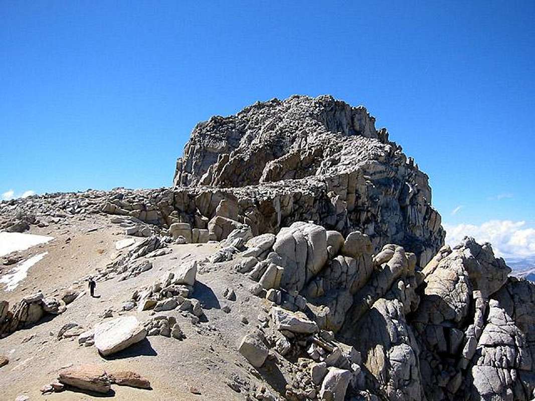
The reason I added on this last blog to this series about my hike to the summit of Mt. Conness is because of the following cemented rock structure. There were a few like this up there, but this one caught my eye:
I looked closely and saw the name S.H. Finley, Santa Ana, Cal, 1890. Who in the world is that? Even stranger is I live close to Santa Ana so I wanted to find out what was going on here.
A simple Google search revealed that Solomon Henderson Finley was an Orange County engineer. Google has a lot items related to him. He was picked along with a bunch of other experts to lead a scientific expedition to survey the area for map making. He is the man sitting down in the middle of this picture of the expedition crew to Mt. Conness.
The following is a picture of some of the members of the men on top of Mt. Conness. That is the observatory they built up there for the tests they needed to make. I would have loved to see how they carried the parts of the building up there along with the rest of the heavy equipment.
The funny thing is I had no clue about this when I was up there. I got very close to getting the exact same shot. To get the shot above I would have to move to the left a few feet. You should be able to line up the same rocks. Wow, a comparison with a 118 year old picture! Not a lot has changed!
For more on the survey crew of 1890, refer to the following article by George Davidson. He is the white bearded man in both of the old pictures above. He led the team.
or

For more about the life of S.H. Finley:

Friday, November 28, 2008

The Mt. Conness Hike (Part 3)

(GPS: N37 58.025 W119 19.280)
 
I knew by getting past the catwalk from the previous entry that the rest of the climb over the rest of the granite blocks would be simple. When I got to the top it was sometime past 11am or so. There was a strange haze in the east and southeastern directions. The views were okay, but not as great as I would have liked for picture taking. I was not too bothered by this since I had good views for some of the nearby areas and had taken pictures from another nearby peak a week before anyways. Really, the fun in this one was experiencing that "stairway."

The following is looking towards the east. Mt. Warren is in the distance, half of Saddlebag Lake is down below, Greenstone Lake is to the left of Saddlebag, and the glacier is just below. Unfortunately, the glacier has that late season dry look to it. There are some positive and negative consequences of doing this hike later in the season, and the lack of snow and ice in the views is one of them.
In the next one you can see Lundy Canyon on the left side in the background. There are a bunch of lakes throughout this picture. There is a trail I have hiked down there that goes around a lot of those lakes, and I had hoped to do it over the last weekend in Halloween to get a picture of Conness from that direction. The storm conditions prevented that so I may have to do that next year. I had never seen those turquoise colored lakes before. I always like those exotic looking colored lakes.
The following picture is not that impressive in itself. It is the northern side of the summit. What is interesting to me is you can see some of Sawtooth Ridge and Matterhorn Peak (my logo) from this direction.
There she is! I had pictures from this direction of it a week before. Usually, there is a heart shaped piece of ice that sticks around until late in the season. It was there a week before, but by the time of this picture it was gone. What you can see is the "easy" class 2 scree filed route to the summit from this direction. In between the Matterhorn and the pyramid looking peak to the far right is Horseshoe Pass which drains all the way to Twin Lakes near Bridgeport. The Horseshoe Pass route from the trailhead at Upper Twin (near Mono Village) is what I usually take to climb this mountain.
This is the western direction. There were some streaky clouds in that direction. This is all Yosemite. I believe the area on the far right is the Hetch Hetchy Valley area. I have never been there, but it would make sense. Yosemite Valley is on the background on left side.
You can barely see it, but Half-Dome is in the very background middle of this picture. I wanted to climb Mt. Hoffman this year which is the high peak to the right in this picture, but that will have to wait until next year.
Here is a zoom in of Half-Dome. The higher peak to the left is Clouds Rest where I have written about before (Part 1, Part 2, Part 3). The fun part here is that little lake to the lower right should be Tenaya Lake. If so, then this we are looking back down at where Ansel Adams took his famous shot of Mt. Conness. Compare with this picture on the Ansel Adams site.
This is the southern side. The highest peak of importance is Mt. Lyell in the background of the left side. I have better pictures of it from a different mountain peak hike.

These pictures really could use a lot of photoshop work, the views are more fun with snow around on completely clear day, and they do not really capture the whole experience of being up there. I hope to go back on a better day. The interesting thing about this hike is that usually being in the backcountry like this I usually see at least one or two people on the way up or coming back. There was no one out there this entire day! I had all this area to myself for this day.
I have one more follow up blog I want do that will cover some interesting historical stuff I found out when I got home.

The Guardian of Mt. Conness (Youtube Version)

The Guardian of Mt. Conness (Vimeo Version)

For The Guardian of Mt. Conness video I used the following from Incompetech: Heavy Interlude, Coming Storm - Preview A, Mechanolith, Faceoff, and Virtutes Instrumenti. The non-Incompetech Spaghetti Western sounding piece is called "I Diavoli Dello Spazio" from a science fiction movie called Snow Devils.

Thursday, November 27, 2008

The Mt. Conness Hike (Part 2)

(AKA The Exposed Scary Part)
Happy Thanksgiving (for those of us who celebrate it in the U.S.A.)! There is a lot for me to be thankful for. This is a good blog for Thanksgiving day. I am thankful for not slipping to my death on this part! Well, it really is not that dramatic. Let me explain.
 
Back in June I looked at a bunch of pictures I had collected on the web about this part of the final ascent. It is the type of thing that kept me awake a few hours at night thinking about it. Did I really want to do this?
This is about half of the way up on what I refer to as the "stairway." Click this link to see my favorite picture I found online of it. It reminds me of a snake that is rising up. Or, what you might see in a fantasy movie with a castle stronghold at the very top. Although it looks like a true granite rock scramble to the top, it really is not. There is a clear trail through the granite blocks as you ascend higher and higher. It really is easy to climb, but maybe not for those who fear heights. The following is the most "scary" part in that it is the most exposed.
The catwalk above has drop offs on both sides. Then you cross the knife-edge with a little more than a foot in width to walk on. It is about a 10-15 foot crossing. On the right side of me I had the glacier below:
On the left side of me I had this:
Here is this part looking back to where I was just at. I then ascended the rocks to the left of the picture. There was another drop off there too.
Was all of this really something to stress over? Although I probably should say, "Oh this was the most dangerous thing I have ever done! Watch my video! I could have died! I almost did!" I was actually laughing as I was crossing it here. In fact, originally, when I shot the video I did not hold the camera thinking I would need both hands to cross. I realized it really was not that dramatic here, and I could get by with with one hand holding the camera since I had solid footing all the way across. When I came down I tried to shoot more pictures and video of this area to reveal that it is not that scary here, but looking at the pictures and footage at home I realized that I do not think I can show how secure this area really is. The earlier part of the hike where I crossed the pass had more danger issues going up and down. In this area, sure you have to becareful and not make any mistakes, but it really is easy and fun to cross. Of course, if a heavy wind or a earthquake hit at the wrong time...you are much safer here than driving on the streets or freeways where I live. Do not let this part of the hike discourage you if you want to do it.
Both of the above and below pictures are looking back at the snake like stairway that I climbed.
In the background you can see Mt. Dana. Unfortunately, there was some haze in the air that probably went away in about an hour or two because of the angle of the sun. In the next blog entry I will show how the area looked from the summit. The whole "stairway" section only takes about 15 minutes or so. It is exposed with a drop of few a hundred to thousand feet on the sides, but the above pictures are the most dramatic parts of it.

The Guardian of Mt. Conness (Youtube Version)

The Guardian of Mt. Conness (Vimeo Version)

For The Guardian of Mt. Conness video I used the following from Incompetech: Heavy Interlude, Coming Storm - Preview A, Mechanolith, Faceoff, and Virtutes Instrumenti. The non-Incompetech Spaghetti Western sounding piece is called "I Diavoli Dello Spazio" from a science fiction movie called Snow Devils.

Wednesday, November 26, 2008

The Mt. Conness Hike (Part 1)

(GPS: N37 57.145 W119 18.665)

This will be the first of a few entries on this mountain hike.

Two years ago when I was on Tioga Peak I viewed the area I would hike and climb this year. Last year, after I had climbed Mt. Whitney about two months earlier, I attempted this hike the day after my drive from So. Cal. For some reason my legs were just not moving right. After taking longer than I thought I would to get to where my pictures will start in this blog, I turned around. At that time I thought I would never be able to get to the base of Mt. Conness, not to mention the summit.

This year, after climbing another mountain the week before, I reached the summit. Since I had just climbed another mountain, and had climbed Mt. Whitney a month before, I was not as motivated to do this one. I was relaxed, but also ready to turn around at any point if I did not like the conditions.

I took a ton of pictures and video for this hike. I am skipping the first part of the hike which starts near Saddlebag Lake. Basically, after about two hours of going through an alpine forest I finally reached the following area:
This is the south slope from the east side. There are more direct routes to Mt. Conness, but this is the easiest one to do. The key is you have to be here later in the season or it will have too much ice. If one has an ice axe and crampons then one could try this, but mistakes can be fatal. Since it was not a great snow season there was really no issue here, but going down was kind of slow and rough.
This is near the very top to get to the pass. I had seen the rectangular rock at the very top online in someone else's pictures. I saw it from way below when I was there, and it was my target to get up to. It took about thirty minutes to get to the pass which is filled with scree and class 3 rock. In all honesty, even when you see the later sections near the end of the hike to the top, this is probably the most difficult part of this route.
I looked back down from where I had climbed. I then looked to the right of me which is in the northern direction and saw where I had to go next. There is a trail in the sand here which was good to see.
I looked back and saw how far I had come in about two and half hours.
It is always fun to find different ways of entering Yosemite apart from the main vehicle entrances. You may not see them in the picture below, but you should be able to click the pictures and see two different lakes. One down below is really marshy looking like a jigsaw puzzle. The other is in the distance.
At this point I was just glad to have gotten over the pass and much further. I knew for sure I could reach the base of the summit (aka the summit plateau). Whether I could get to the top or not was a different story. It took another thirty to forty-five minutes until I finally saw the actual peak summit.
There is a famous Ansel Adams picture of Mt. Conness that is taken from Tenaya Lake. The mountain top can be seen from other areas, but from the area at Saddlebag Lake I started at one cannot see the top. I had hoped to get more around Saddlebag Lake to take pictures of it during the last weekend of October, but the storm conditions were too bad so I did not even bother trying.
There still is some gradual uphill hiking here, but it is all trail. Much like other summits I have climbed there is a good portion of it like walking along a sandy beach, but with a bunch of granite rock around.

At this point the final ascent to the summit starts to look like a stairway. I think of it as a type of snake. I was very excited to see this since I had seen it in pictures, but never thought I might actually experience it. I knew the "scary" parts were about to come with the most exposure.

The Guardian of Mt. Conness (Youtube Version)

The Guardian of Mt. Conness (Vimeo Version)

For The Guardian of Mt. Conness video I used the following from Incompetech: Heavy Interlude, Coming Storm - Preview A, Mechanolith, Faceoff, and Virtutes Instrumenti. The non-Incompetech Spaghetti Western sounding piece is called "I Diavoli Dello Spazio" from a science fiction movie called Snow Devils.

Tuesday, November 25, 2008

Why Do I Climb?

A few months ago I was going through a mini-crisis. It had to do with my motivation for hiking and climbing mountains. In the past few years I have accomplished quite a few of my goals regarding getting to the summit of various mountains. This past summer it got to the point where I was not really enjoying it anymore.

Back at the end of July I did Mt. Whitney again. Let me preface what happened this year by saying that the experience of getting to the top of that mountain last year was awesome. There was one point I did not think I would make it, but once I did I took in all the views and the trip down was a celebration. For about a week after the hike I was "high" and then life went back to normal.

It was interesting for me to read this thread on The Whitney Portal Site titled Post Whitney Depression. It is not only this person since I have read various messages and heard people talk like this before. For me, I can kind of understand what they are saying in that a person spends a long time preparing for that mountain, they get to the top, and then they go through a down period. What I do not get out of that is, "What do I do next?" That type of question boggles my mind. It is as if the rest of the Sierra Nevada (or any other mountains in the world) do not really exist. That was never a question for me. Part of me wants to tell a person, for my own very selfish reasons, that they are right and Whitney is the best they are going to find in the Eastern Sierra so do not waste time looking elsewhere.

I did get to the summit again this year. This time it was not as fun for me. There are a bunch of reasons why and I will go into them at a future blog. The accomplishment was not as exciting this time around. I had people congratulating as I came down, but as they did so I was thinking, "I did this last year!" At some points I felt like I just wanted to get the hike over with. I had to rationalize why I was doing it by telling myself the reason I needed to do it was to get the video footage I did not get from the year before. In fact, I was thinking that I better do the video footage because this will be the last time I do this hike. Whether it is or not I can not say, but I have no plans to return at this time.

When I went back to the Eastern Sierra after this I had to ask myself why I continue to climb this mountains. I realized the preperation and anxiety before the hikes was really bothering me in such a way that I was not enjoying some of the other things I like to do. For example, it is one thing for me to visit movie locations where I just relax and drive to those areas. It is another thing to plan long day hikes where so much can go wrong. There is a lot of work involved, and I am not just talking about staying in shape.

I did get to the top of a few more mountain peaks and did do some other hikes this year. The question still remained about why I do this. I thought about it as I was climbing those mountain peaks.

First, as one would expect to come out of me, the scenery has to be good. With almost any Sierra hike you will get some good scenery. I do not enjoy the hikes in So. California as much because of this. Looking down over big cities is not as interesting to me, but I still do those hikes when I need a quick fix. The thing about Mt. Whitney is that I would take its scenery over a lot of things, but it is not as impressive as a lot of other areas I have been. My big problem this year is after I did it the first time I had "burned" in the scenery images into my head in such a way that when I came back this year I was just bored with what I was seeing. That is looking down from the summit. Looking up at it from the Alabama Hills is a different story and is the classic image shown so many times in pictures and movies. All I am saying here is that there are so many other better scenic hikes that I would much rather do. Sometimes there are people on the Whitney Portal message board that mention how many times they have climbed Mt. Whitney. 5, 10, 30+ times, and this is so puzzling to me since there are so many other better climbs out there. I need new experiences if I am going to put that much work in to a mountain hike.

Another thing is there has to be intrinsic value to the hike. Meaning, I am not doing this to impress other people. I do enjoy showing where I have been to others, but that is hardly the point of it. The hike and scenery have to be good in themselves. On one of the boards I have read in the past there is a person that always likes to put pictures up with that person's face in a bunch of the shots. Okay, a few pictures like that are fine, but week after week of that sort of thing really gets old. Let me see the scenery and not your face and body all the time! I do not see climbing mountains and hikes as some sort of social networking thing. At least, not the major focus of doing it which leads to my next point.

This is related to the scenery in that I feel I am viewing artwork in nature. A lot of well known people that have hiked and taken pictures of the Sierra tend to look at it in a very religious or spirtual sense. I am no different in that I feel I am experiencing the artwork of God in nature. When you are having that 1st person experience of these areas you do feel like there is something transcendent or much more powerful going on. It is the "WOW!" factor of it all. Last month while I was on the Ansel Adams tour at the festival the guide said that whenever he finishes taking that one picture he set out for he finishes by saying "Thanks!" He then said he did not know who or what he was thanking, but even with that agnostic approach I think he was still hinting at what I am refering to. It is interesting for me to admit that every single picture and video I take never really capture the 1st person experience of being at these mountains or locations. I always encourage people to visit these areas themselves if they can. What I show is fine, but I really think if ones goes these areas they will have a very powerful experience.

Honestly, I am not a guy that wants to do technical rock climbs. I enjoy doing some of the easier trails and off trail scrambles. These are the class 1, 2, or 3 hikes. In fact, if I am told there is an easier trail up a mountain I will usually always take it. This is not really a sport for me. I kind of realized this year that if I get in one or two mountain summits a year then I am happy. I do not have to do every one out there either. I am going to make a point of trying to do more hikes that just go over some passes. There is a lots of stuff out there, but at some point I realize that this will come to an end for me.

I wanted to bring this issue up because it was a major issue for me this last summer. Sometimes I may act as if these long epic mountain climbs are really easy. In some ways the physical parts are easy in that I do not really have to train very hard for them and do not suffer from elevation sickness like others seem to do. The big problem I have encountered recently was the mental part and the motivation of doing it.

My next blog will show one of the classic and exciting peak hikes that I did. It is one I have wanted to show since I did it. The time has come!

Friday, November 21, 2008

The Iron Man Exhibit at the Lone Pine Film Museum

One of the new exhibits at the Lone Pine Film Museum is one that shows some of the props and costumes used in the recent Iron Man movie. They are on loan from the movie company, and I do not know how long they will be there for. Naturally, the items are in their Sci-Fi area since most of the rest of the exhibits are Western related.

The big "rock" you see is what I think Robert Downey was leaning on at the beginning of the movie. I suspected that rock was not real, but never knew with certainty. The suit in the background is the one he wore in the movie. The clothes are the right side are what I think one of the lead bad guys wore in the movie.
One of the "bombs" they used.
These are all parts from the original Iron Man Mark I suit.
Here is a close up of one of the plates.
The question now is will they come back to this area for the sequel? If you have not seen my previous entries on this movie then do a search for "Iron Man" in the box in the upper right hand corner of this blog.

Monday, November 17, 2008

Robert Mitchum at the Lone Pine (The Alabama Hills Series)

(GPS: N36° 36.370 W118° 07.000)
Alright, it has been a few months since my last Alabama Hills movie location. If there was one actor I feel like I try to "emulate" in the real world it would be Robert Mitchum. Of course, if you saw me in the real world you would come to a different conclusion. In my mind, I act like him. lol. He is one of the best of the strong silent types. Mitchum started out in small parts in Hopalong Cassidy movies. Many of those movies were filmed out in the Alabama Hills. He really got his career started out there. He starred in two b-movies there: West of the Pecos and Nevada. As I remember, Tim Holt was to star in them, but went off to fight in WW2 so Mitchum had the part. It is interesting to note that Richard Martin, Tim Holt's sidekick, he is Mitchum's sidekick in these movies.
This is one of the first "difficult" locations I found when I first started to try to find locations in the Alabama Hills. This one took some work for me to find. Keep in mind I was going off of memory and not printing out pictures to take with me at the time. It took me a trip or two to figure it out. My location intuition eventually took me to it. I was so proud. Then I later found out that it was on one of the tours you can take at the festival. If I had only known about the tour at that time.

This was taken during the recent film festival. I am standing right in front of the plaque that they had for this location. You can see the weather conditions were very cloudy in the background. You can compare the grounded rock in the foreground and the bunch of rocks in the middle (slightly to the left) background. The "Lone Pine" would have been just in middle, and maybe slightly to the right in my picture. My assumption is that it was "planted" there for the movie, but I could be wrong about that.
Robert was supposed to meet his sidekicks at the "Lone Pine." He hears a shotgun blast and goes to investigate it.
Naturally, in the b-western formula, the good guy gets framed for murder and spends the rest of the movie trying to prove his innocence. So, Mitchum, who has good intentions, get's accused of murder because he is at the wrong place at the wrong time.
I took this picture over the summer. I do not have the right camera angle, in which I would move further to the right, but this is good enough. That is the same rock he and his sidekicks both pass.
I like this narrow passage they go through. It has a nice feature of Lone Pine Peak in the background.
It is exactly the same as it was in 1944, but with one change. This huge rock dropped down:
You can get by it, but it is in the way. Usually, these rock formations show little change, but I have encountered a few areas in the Alabama Hills where rocks have come crashing down. These few areas look different now compared to the movies.

I mentioned this in the video, but I might as well do it here too. The term "Lone Pine" is used only twice in all the Alabama Hills movies filmed there. It was mentioned once in one of Tom Mix's sound movies where a lady is driven into town and comments how beautiful Lone Pine is. This Mitchum movie, Nevada, is the only one I know of that hints at the town's origin name. Supposedly, there was a lone pine that existed somewhere out there. This is how the town got its name. The movie makes a nice homage to it.

(Edit 12/3)

I wanted to come back to this entry to add one more thing about the horse Robert Mitchum used in this movie. His name is Steel. If you look at the picture above of him you will notice he has three white stockings. Steel was a very popular horse for actors in the 1930's to 1940's. I will name a few: Buffalo Bill (Joel McCrea), Four Faces West (Joel McCrea), Tall in the Saddle (John Wayne), Yellow Sky (Gregory Peck), Across the Wide Missouri (Clark Gable), It's a Big Country (Gary Cooper), She Wore a Yellow Ribbon (Ben Johnson horse), Rio Grande (Ben Johnson's horse), West of the Pecos (Robert Mitchum), and, of course, Nevada (Robert Mitchum). Steel was one of those horses that was so well trained it would never buck its riders off even if a scene in a movie called for it. Unfortunately, Steel developed a nervous twich of having guns fired to close to his ears which began ruining his appearance. He had to be put down because of this. I wanted to mention this because sometimes these horses are better actors than their riders. If you watch for them you will see some of the same horses in these movies.

For more on horses in movies check out Petrine Mitchum's Hollywood Hoofbeats: Trails Blazed Across the Silver Screen. I met Petrine, Robert Mitchum's daughter, last year. She is super cool and is very knowledgeable about horses. The book is a must have for the content and the pictures!

Tuesday, November 11, 2008

Panum Crater

(GPS: N37° 55.660 W119° 02.760)
Around 40, 000 years ago volcanic eruptions started to occur here in the Mono area and further south near Mammoth, CA (The Mono-Inyo Craters). Panum Crater is relatively recent with its eruption taken place around 650 years ago. What you see above is the inner circle of the crater. I started the hike going on the "rim trail" around the rim of the crater.
Let me try to explain this by just rehashing what I have read since I am not a geologist or scientist of any sort. Magma rose up and reached the cool water which created an explosion that produced the crater you see above and below. Afterwords, more magma (lava when it reaches the surface) came up in the middle part of the crater creating the inner dome part you see.
I headed back and went to the "plug trail" which takes you inside the intermost dome of the crater. You come out and in an "otherworldly" type of area:
There are lots of these spires around... Tons of obsidian and pumice around...
This area reminds me of a fantasy movie or something you might see in the Lord of the Rings books/movies.
It is one of those areas that I am not sure if videos and pictures do it justice, but it is out of this world! If I were to change the backgrounds in these pictures it might look like I was on another planet. A few other links for further information: