(GPS: N 37° 46.065 W 119° 29.355)
Here is another shot getting closer to the top of Cloud's Rest. The hiking trail is to the right as you come around.
 This is close to the final ascent. I liked how all of these slab rocks were all leveled out on each other. As I was coming down I thought it looked like a loaf of break from a different angle.
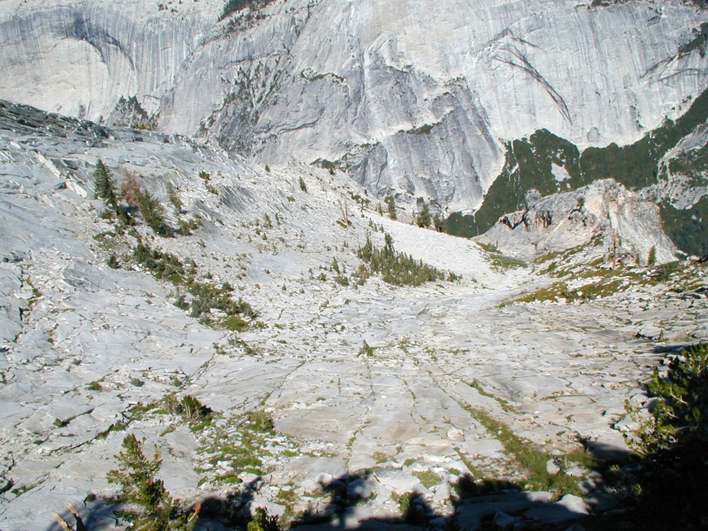 I liked this area because of the way the slabs stacked on each other. When we were going down it looked like a loaf of bread from a different angle.
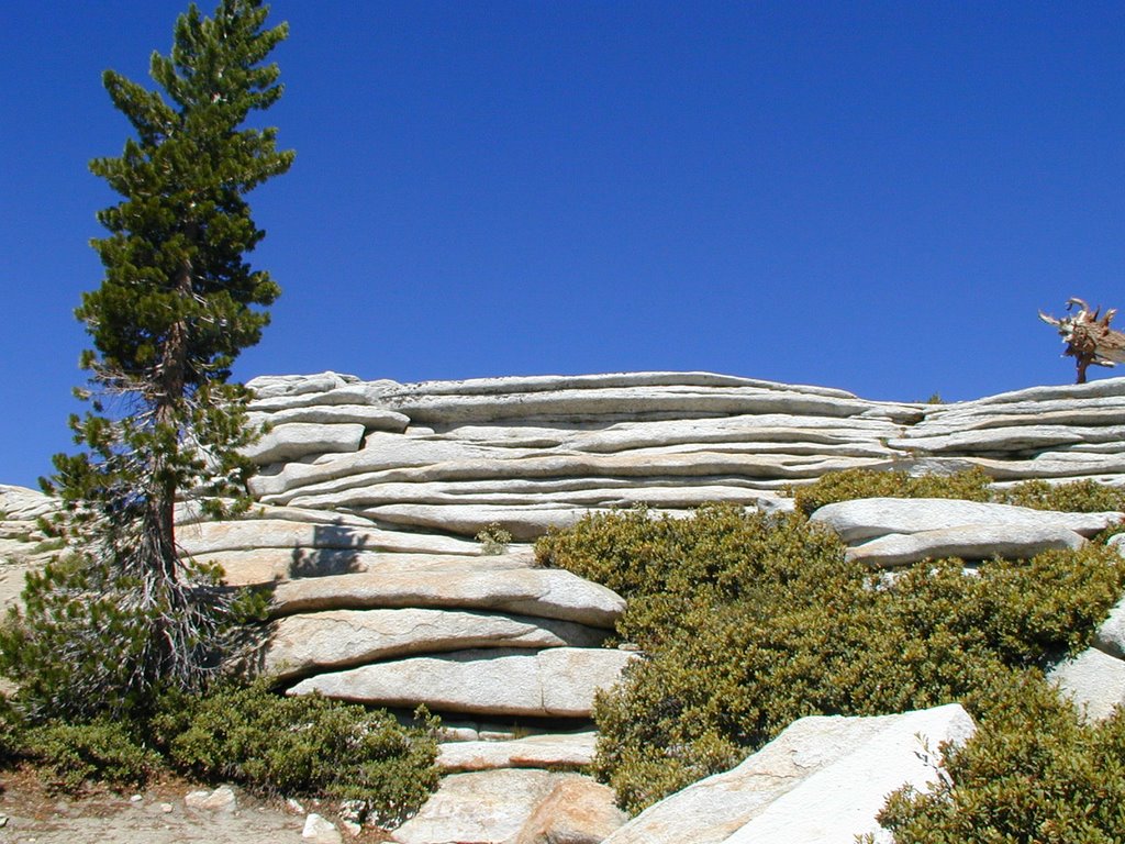 The final ascent. One concern I read about is on a windy day one has to worry about staying close to the middle since the drop off of 1000's of feet on the sides. At some points you have about 15 feet to across to work with. Since we had been on more dangerous climbs we were not too concerned about these dramatic drop offs with little room. This was a piece of cake compared to those.
 This is looking back down from where we started near the summit.
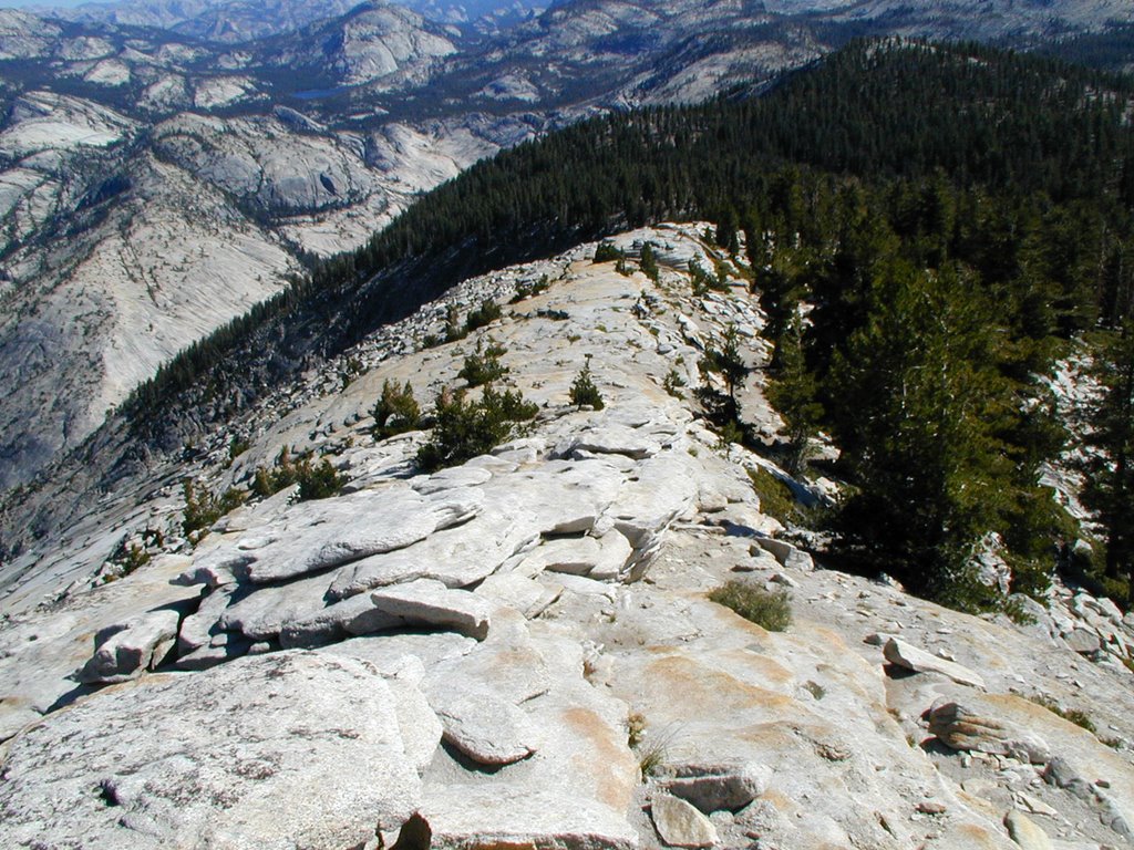 This is on the summit looking toward the east. The highest area is Sawtooth Ridge with Matterhorn Peak being the highest point.
 More of the summit looking east. There is lots of room to roam around on at this summit. Lots of bees too buzzing around.
 Okay, now we are looking at the really awesome Half-Dome and Yosemite Valley below.
 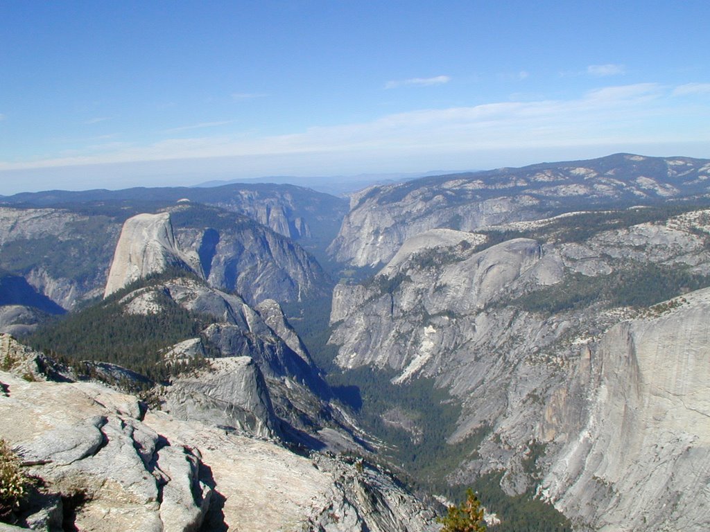 More from the summit in my next post.