Monday, June 25, 2007

San Diego (Some Like It Hot)

aka Hotel Del Coronado
I have been a little behind in some of entries I intended to write. I have some work I need to do with some peak hikes I intend to write up so I should be doing that as the summer goes on. Rather than throw out some more Alabama Hills pictures which I can always do and will continue to do, I thought I would show some stuff I took in San Diego some months back. I have always been a fan of California historical landmarks so lets start here:
I must admit that I am not the biggest fan of San Diego. The times I have gone there I have felt I did not have that much to do. When I was kid there was always the zoo and Sea World, but now I just do not enjoy it as much. There are some things I want to go back to in the next few months, but to me it always seems just like a big housing development. Hotel del Coronado is one of the few landmarks that is very powerful in San Diego. It was build in the mid-1880's. To spend time there you definitely have to have some money.
Many famous people have spent time here. It is well known from the Marilyn Monroe movie Some Like It Hot and a few others. It has an interesting structure to it.
The following picture, from what I remember, was a furnace. I can't remember anymore details to it.
Here is the famous Dragon Tree.
I have more from San Diego for some other time. I am a person who is not usually impressed with the more expensive aspects of locations and life. I am more into the natural beauty of the areas I have visited. However, there are some out there that might read this that like this sort of think so I thought I would include it. It does have some important historical value, as well as, movie history to it. Please refer to the following links for more information:

Thursday, May 24, 2007

Whatever Happened To Randolph Scott? (The Alabama Hills Series)

(GPS: N36 36.205 W118 06.895)

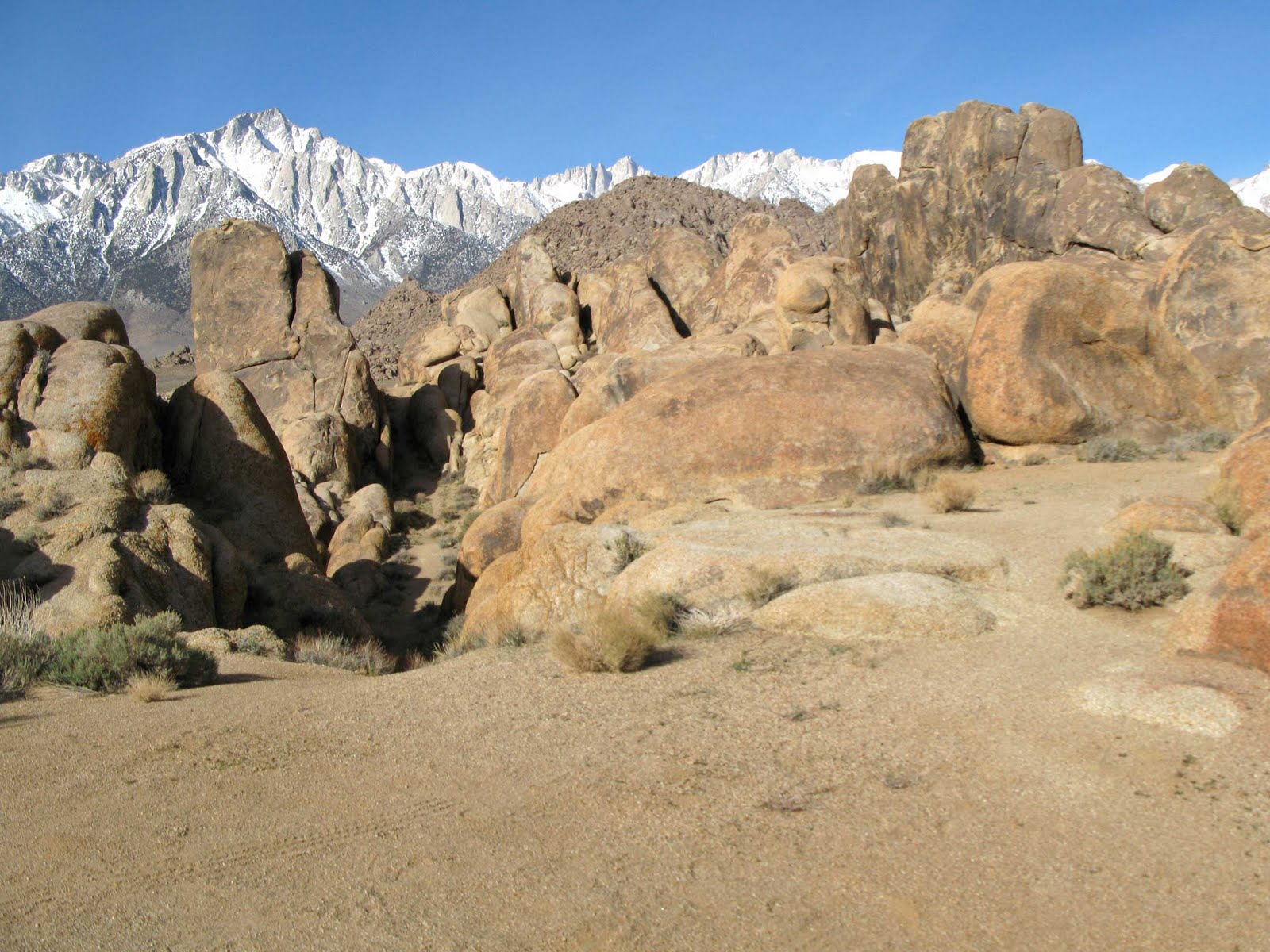
He's Riding Lonesome in the Alabama Hills. The following pictures from Comanche Station and Ride Lonesome are in an area known as Triple Camp. To get to this area you have to go through some of the other areas I have shown in previous entries: Lone Ranger Canyon, Gene Autry Rock, and you actually turn right when you approach Gary Cooper Rock. In both movies Randolph Scott heads up this narrow passage to his destination. Let's look at this scene from the beginning of Comanche Station:
You can compare the rocks with this picture.
The following picture shows that narrow passage one would take to get to the top. In Comanche Station they turn to the south which is left from the camera's point of view:
But, in Ride Lonesome. Randolph Scott captures James Best (aka the Sheriff of the old Dukes of Hazzard tv series) by turning north which is right from the camera's point of view:
This picture you can compare with the above two. The rock at the furthest to the right of the picture is the same one Randolph Scott is standing in front of just above. However, that is where he captured him.
This is one of my favorite areas in the Alabama Hills. Gary Cooper went through that narrow passage to in Lives of the Bengal Lancers. It is interesting to note though if you would go all the way to the other side it dead ends. Meaning, it looks like they can approach with their horses from that area, but in the real world there is a cliff there with rocks that would be impossible to cross with a horse.

Tuesday, April 24, 2007

Bronson Canyon AKA Lone Ranger TV Ambush (Part 2)

Last time I went through the tunnel and ended up at the entrance to the other side. This time I thought I would show a bit of the other side. The following is a picture of me at the end of the canyon shooting back.If you do a Lone Ranger search on my blog you will find that I have done other things regarding Lone Ranger movie and tv sites. This time I thought I would compare with the tv version of the original ambush that the Cavendish did on the Texas Rangers in the story.
The following picture shows a bit more than the above. The above is closer to the right side in the picture below. The little small tunnel is usually blocked out in most tv and movies that I have seen.
In the story only one Texas Ranger lived. Here is at the entrance to the main tunnel or cave.

Here is the loyal Tonto coming to rescue.
If you compare to the above pictures you can see the "wall" next to the tunnel entrance.
On the way out I took a picture of the following sign. One thing a camerman had to becareful of us accidentally getting this sign in the filming since it would be really easy to. You can easily see it in the background near the entrance to the area.

Saturday, April 14, 2007

Bronson Canyon AKA The Batcave (Part 1)

(GPS: N34 07.271 W118 18.882)

Sometime back I visited Bronson Canyon in Los Angeles. It is actually in Griffith Park near the Hollywood sign. By itself, it really isn't that impressive. The area was used to get rocks for paving the streets of Hollywood and the San Pedro Breakwater. One just parks, takes a short elevated walk to a closed off area for vehicles, then goes around a corner, and you reach the area where it culdesacks. The reason the area is significant is because the area has been filmed so many times in all sorts of different movies. It is one of the most filmed places on the planet. It is most popular for this old tv series:
That is the batmobile popping out of the batcave. The old 1960's Batman tv series used the part of the area in most of the episodes when it showed them coming out of the batcave. Here it is today:
It is the same area, but looks like it has been cleared out a bit, or what you see in the Batman picture is a lot of prop bushes. Either way you can see that it is not a cave, but really a tunnel. I went through the tunnel and ended up on the other side. There are actually a few other outlets nearby the main end of the tunnel. Look at the climatic moment in the following picture from The Searchers.

The stunt doubles for John Wayne and Natalie Wood have just run down the mountain on the other side and ended up here. Funny, most of the movie took place in the Monument Valley, but here is the most important scene taking place in lowly Bronson Canyon's caves. The angle may not be right, but here is the area:
In the alternative ending of the movie, Army of Darkness, the exact same area is used. If you were to move out of the tunnel and look back this is what you would see:
In the Army of Darkness movie's alternative ending, you see Ash's (Bruce Campbell) car being taken into the cave from this angle. In my next entry I will show more from this area and its relation to movies and tv.

Tuesday, March 06, 2007

"Come on, now. It's gonna be a nice day" (The Alabama Hills Series)

(GPS: N36 36.608 W118 07.695)

I have actually talked about this area before. I call it the "The Tall T" area since most of the movie was filmed at this point. Refer to my other previous entries about this:

I like the ending of this movie because after the bad guys are defeated Randolph Scott "comforts" Maureen O'Sullivan with the following words:
And, yes, he is very dry and wooden in saying it. So, It comes across a little too sarcastically. In the picture below the exact location would be in the lower middle of the road. I parked to the left of there. You can see Lone Pine peak in the background in both pictures. Mt. Whitney is further to the right in my picture.
Of course, whenever I am in the Alabama Hills area it is always a nice day no matter what the weather is like!

The Tall T (Youtube Video)

The music in the video is taken from Song of the Volga Boatmen at Incompetech.com

Monday, March 05, 2007

Civil War Reenactment (Labor Day Weekend, 2006)

Yeah, But You Don't Have to Lose!

During last years Labor Day, I went to the Huntington Beach Library in California for their Civil War Days. I decided to go to the opening battle reenactment and check it out. I was telling everyone that this year the Confederacy would win! This is sort of a running joke I have since watching an episode of Southpark where Cartman tries to get the southern side motivated to actually win the war. Knowing the true history of the events, as most people in the U.S. do, I was really shocked when I got to the library area.

I actually saw Abraham Lincoln later in the lunch area. He was telling everyone he was 120 years old or so.
The above is Jefferson Davis of the South. I saw the Confederacy side as soon as I got there and I was naturally very interested to see what they were all about. One of the men at the Richmond, Virginia "Capital" house was telling everyone that, "We can still win this war! It is 1862, and I like our chances!" Funny!
Above is General Lee near his tent. When I got there most of the troops of the Confederacy were marching and preparing for battle. Jefferson Davis actually gave them a pep talk.
I went to the Union side and was shocked to see that there was hardly anyone around. I figured they must have been out marching, but no one was around. A lot of tents, but a lot of empty space. I did finally see some soldiers marching around, but the area was not as well populated as the Confederate side. I ate lunch and then prepared for the battle on the field.
The Confederacy struck first. It was like being on the sidelines of a football field that was shaped like a slight arch. There were many people around so it was difficult to take good pictures. The Union pushed the Confederacy back. The picture above is near the end when the South stole the cannon.
The above picture is some Union troops attacking.
Again, there were people all around.
The funny thing is the Confederacy actually kicked Union tail all over the place. This was a solid Union defeat. I was laughing inside because this year the Confederacy had won. However, keep in mind that they would skirmish another three times, but I would not be there since I left just after this.

I went to listen to one of the southern men speak about their weapons. He went into this long diatribe about how, "Lets suppose that God forbid the South loses the war. Wouldn't you suppose that 'West Virginia', the land stolen by the Union, would be returned to Virginia. By all rights, morally, legally, biblically, and in all intellectually honesty it belongs to Virginia." At that point I was wondering what type of alternative universe I was living in. It was very bizarre.

Overall, I had some fun that day. I learned that I would have probably wanted to be on the Confederacy side since they were more charismatic. They just kicked butt all the time I was there. All the different regiments were there looking for recruits. I even saw some Texas Rangers. I only saw one black guy there. Which side was he on you ask? The Confederacy! Who could blame him!

As a side note, I have three relatives that fought in the Civil War. A great grandfather, Seaborn Yarbrough Sr. fought in the Confederacy. I have two other relatives who fought for the North. They are a little more well known. One would be Rutherford B. Hayes who would become President; he is my 4th cousin. Also, John Millholland, who I have the honorable discharge papers of, is another great grandfather. If you ever read a biography about George Washington Carver who might come across John and Helen Millholland who he stayed with and encouraged him to go to college. Those are my great grandparents.

Wednesday, February 14, 2007

The CIA's Death Valley Albatross (Part 3)

Final Examinations
Some more of the tail:

These types of pictures I like since they show the steep angle and miles beyond:
You can see Telescope Peak in the background on this one. Unfortunatley, it was a little too hazy on this day.
The tip and beyond:
There was an interesting story on this next picture. It looked like some sort of cloth or fabric when you look at it. However, it was obviously metallic when you touch it. I was told that this was actually rubber de-icing boots from the wings that over the years of being there had turned into steel!

This gives you a good idea of what it is like when you approach the aircraft. I will always be amazed it actually stuck there and did not tumble down below. It is sturdy there, and it remains one of the most interesting monuments of Death Valley.
After we got all these pictures and videos we headed back to the car. At this point it was mid-morning, and I knew the trip back would be more difficult. It felt like I encountered more scree on the way back. Then, we finally reached Towne Peak again!

Then we climbed over the smaller peaks until we saw the car. Yet, like one of the first pictures I showed. We still had a long way down. I think I reached the car at some time after 2pm. It was about a 9 hour hike.

When I got back to the car I started drinking. I went through about ten different types of drinks (water, Gatorade, Diet Coke, etc.) that day and still had not quenched my thirst.
That evening I left out some ice to melt into ice water; I just could not get enough. I went to sleep pretty dehydrated. I felt great though about the journey. I felt better the next day, but when I got home I went through two large glasses of water and it did not even phase me! lol! I could have kept drinking.

This ends my epic adventure to this aircraft. I spent a lot of time on this and showed a bunch of pictures since it was such a unique thing.

(Edit: I did this hike again in 2014. I took a video of it which can be found here: Hunting a Bird in Death Valley)

The CIA's Death Valley Albatross (Part 2)

Exploring the Aircraft
As I tried to explain in the last entry, after the hike to get here, walking down the sandy scree, and then trying to walk around the aircraft at steep angle, it was not easy moving around. I was very slow walking around. Especially when I was underneath it. An interesting shot:
If you look closely you might see some of the debris below. It was way down there. No, I would not suggest trying to reach the plane from this way. That is seriously dangerous. One of the detached wings:
This was underneath it. Very cramped.
Here is part of the inside of the craft. You can see the chair in there.
The tail of the aircraft:
1001.
Stay tuned for my next entry that finishes up the pictures.

(Edit: I did this hike again in 2014. I took a video of it which can be found here: Hunting a Bird in Death Valley)

Tuesday, February 13, 2007

The CIA's Death Valley Albatross (Part 1)

The Descent
(GPS: N36 24.610 W117 19.430)
This is actually a continuation of the recent entries, but I got tired of writing the same titles for another three parts. So I decided to give this a different title for the last three parts of this series.

Before I continue, let me give a link to read the historical account of why this plane is here. It is good reading and gives a better explanation than I can on the crash. Please click this highlighted paragraph for the ALBATROSS ARTICLE.

If you read the article, you will notice in the second to last paragraph it mentions it is very dangerous to do the hike, and not suggested. Apparently, you can see the aircraft from some part of the highway. I would only suggest this hike to a person who is in shape, can deal with warm Death Valley weather, and, very important, can deal with scrambling on scree. I don't enjoy walking on scree.

After having the minor victory of getting to Towne Peak in good time we descended to our final destination.

It took us another hour and fifteen minutes to get to the aircraft. We reached the plane at around 8:45am. The final 150 feet to get to the plane is rather rough. It's a scree slope and you do have to be careful going down or you might really go down. My brother said he had a close call in an area where he lost his trekking pole.
The aircraft is rather intact considering the circumstances. It was a miracle that the craft is still here and not completely destroyed. One of the engines of the twin engine aircraft is what caused the problems and resulted in the crash. Here is one of the engines slightly attached, but mostly on the ground. You might be able to see some of the propeller.
Moving around this area above the aircraft was very difficult.
I was tired. I felt good, but there wasn't any rest here for me. I started shooting pictures and using my camcorder right away. The following area was difficult to descend through so I had to go slowly.

Keep in mind I did all of this twice. Once for the camera and once for the camcorder.
The underside! Notice the little "hill" I have to go over to get to it.
In the next entry I will show some of the inside of the aircraft and the tail.

(Edit: I did this hike again in 2014. I took a video of it which can be found here: Hunting a Bird in Death Valley)