Saturday, November 26, 2011

Reflections at Conness Glacier (The Final Destination)

After that short snow ascent, it practically ended the hike for what I was trying to do that day. Everything flattened out. It was just a matter of walking around the few streams and ponds to get to the lake. This only took a few minutes at most from the above picture. This is not the lake, but what it drains into. The water going into it is what you hear near that point in the video.
However, the final destination was very quiet. Here is how the lake looks when arriving at it. Mt. Conness is the mountain peak in the middle. The other one to the left looks higher, but that is because it is closer to the lake.
Now I just started taking in the moment and checking out this lake.
I did not purposely go here to take pictures of the reflections, but it was still early in the morning so that is how that worked out. I am going to take a few more days to show other pictures I got of this lake.

Friday, November 25, 2011

Reflections at Conness Glacier (The Falls)

After a little more elevation I came across this one that had been excavated by miners at some point in the past. It is not too obvious coming up from the area I came, but I was looking out for it since it was brought up in that Huell Howser episode. In the episode they mention the miners were either after tungsten or gold.
Most of the elevation to this hike is in this section. Keep in mind this is not a major elevation hike compared to most of the mountain hikes around here. You start at around the 10, 000 ft. level near the dam, but we are only talking about 500 ft. to get you to the 10, 500 ft. range at Conness Lake. The main falls of the area are just across the way there. Mt. Conness is to the upper right side of the picture.I got a little closer to the falls.
Up until this point I had an easy time of things. Then I saw this ahead. I was wondering if I would have to turn around from here which would have been a major bummer. I was thinking, "Oh man! I am going to have to come back at another time. I should have waited another month."
The major concern on something like this is not necessarily going up on the snow/ice, which is still a concern, but what happens back down this way. All it would take is the sun melting some of the snow which would make it a lot more slippery, and it could be a really bad situation.

It turns out the only bad part was a section at the beginning of that snow patch. I almost slipped, but I was thinking that it would be a lot worse coming back down over that part. I will have to explain what I did coming down at the end of this series, but for now I just want to note that after climbing this snow patch to where I wanted to go to, the hike was basically over. It was time to just reflect on life, nature, and any other thing that would reflect. ;)

Reflections at Conness Glacier (Youtube Version)

Thursday, November 24, 2011

Reflections at Conness Glacier (Pond Reflections)

After passing Saddlebag Lake the trail continues to other lakes. This is what I normally do and loop the trail back to where I started. However, on this day I crossed over to the east. I am not sure if there are official trails to get where I was going, but there are use trails around. In fact, you don't have to take the way I did it to get there. Eventually, I came across this:
Zooming in with my camera I got this:I headed over to that area to see a few ponds or tiny lakes that I didn't recall being as big as they were that previous time I came. Of course, during that time was during a "dry" season when we had little snow that year. Off to my right, looking in the direction of Mt. Excelsior, this pond gave a nice reflection.Then turning to my left I liked this reflection as well.
Nice illusions to the eye, but the best was yet to come.

Reflections at Conness Glacier (Youtube Version)

Wednesday, November 23, 2011

Reflections at Conness Glacier (Greenstone Lake)

I will be going back and adding GPS coords when I am done with this in the next few days and correcting any typos and the wording. Alright back to where I left off...

After going around Saddlebag one encounters Greenstone Lake. Actually, it depends on which side of the lake you go around on. You can go around on the other side, but it would just take a little longer to get over here.

I had hoped to show the green color of the lake, but since I came through and back during the morning hours it had a refection on it. So, I just took advantage of that.The final destination I was heading toward is in the background. Mt. Conness is the mountain on the left side. Once concern I had was the snow way back in there. I did not bring anything to traverse snow on an incline. I was not totally sure I could get back to where I wanted.This is left of the above picture. A nice reflection there.I did a quick stich of this lake to show you what it looks like as a whole.

Tuesday, November 22, 2011

Reflections at Conness Glacier (Saddlebag Lake)

(GPS: N37 57.900 W119 16.315)

This starts a series of blogs on one of my favorite hiking areas that I have come to every few years since I was a kid. My dad used to love coming here to fish, and I have memories of the family fishing while I would hike around the lakes. The last time I was here I intended to use the pictures and videos to show off the lakes and scenery, but that was the time the smoke was bad due to the Yosemite fire that took place a few years ago. So, I just kept telling myself to come back.

Since then I have not been able to come back to do the exact hike I usually do. Something would come up, or the weather conditions would not be good enough. Even this last summer I did not do the main hike I wanted to do. No big deal...next summer will come soon enough. However, with this area there is a window of opportunity as to when you can be here. Too early in the summer, after a good snow season, one might not be able to drive to the trailhead; too late one might encounter an early snow that gives you the same issue. What it comes down to is about two months out of the whole year where there should be no problems accessing this area. There are exceptions. During dry seasons which did take place a few years ago people were coming here early into the season.

On this short trip the goal was to reach the Conness Lakes area that has the Conness Glacier. I mentioned this one a few years ago after Huell Howser had his Californa's Gold episode here. I will link that at the bottom.

As Huell shows in the episode, one can take a small boat ferry across Saddlebag Lake. When I hike here I don't do that. Part of my enjoyment is walking around Saddlebag Lake which usually takes an extra 30 minutes or so to do.

Looking back to where I started with Mt. Dana in the background. When I was on Mt. Dana a few years ago I was looking down here like I usually like to do. I always like seeing both perspectives as part of the big puzzle at my playground here. Further away and continuing around Saddlebag.Almost around the lake where the main action will take place. I must mention that Mt. Excelsior is in the background, and it too is another area that I was looking down here to get that perspective from up there. Lundy Canyon is in the background, down, and to the right. I was there a few years back, and I hope to have something about it in the future. The reason I have delayed that one is I hope to show you the main hike I normally enjoy doing here which connects to Lundy Canyon. That is the hike I was referring to at the top.I will be heading to the left side of this picture to an area you can't see right now.

My blog on the CG episode with a few of my own pictures can be found HERE.

My Mt. Dana hike can be found HERE.

My Mt. Excelsior hike can be found HERE.

The video:

Reflections at Conness Glacier (Youtube Version)

Monday, November 21, 2011

Ramona Epic #33: R.I.P. Ramona and Juan "Alessandro" Diego

This is the conclusion of this little "mini-series within the series" of blogs dealing with my time near Cahuilla Mt.

Let me preface this one by saying that I am going to be a little more sensative in how I present this than normal. I am not posting any GPS coords, nor any directions how to get to where I was. Although one could probably figure things out just by what I have said previously and what I will say now.

I could probably do everything as normal, but I want to be a little more respectful on this one...I hope anyone reading this blog realizes I try to be respectful everywhere I go. Technically speaking, the graves I visited are on reservation land which can be considered trespassing. On the other hand, the cemetery is literally right next to a casino that anyone can visit (yes, they want you to!) even though it too is on reservation land.

In doing my homework for this one I read a few books and articles. I then corresponded and talked to a few people about this. The main rule I found out is no drugs or alcohol in the cemetery. Other than that, I just used common sense and did not do anything stupid.

Let me also add there are other pictures I have seen of these gravesites on the web. In fact, some are better than mine because I went during the time of the year when the weeds were really growing. Also, I have been told, and read, that in the past Ramona Pageant people have come here and have acted out parts for groups of people. So, it is not like I am the first one to discover these gravesites, or done anything online about them since others have.

Without that out of the way...
The two grave markers in front of me are the gravesites for Ramona Lubo and Juan Diego. Of course, Juan's history was mentioned in Ramona Epic #31.In the above picture is the marker for Ramona Lubo. She was the wife of Juan, witnessed his murder, lived in that same area I was at for #31, then came down here, and lived out her life not too far from the cemetery.

Now below is the grave marker for Juan Diego. These markers were put in long after their deaths by people obviously influenced by the Ramona book or pageant.

Most pictures I have seen of these graves are always clean with no weeds, but forgetting about all the weeds growing nearby you can tell these graves are visited often by the items that are left for them.The woman we know as Ramona Lubo was probably not born with the name of Ramona. Helen Hunt Jackson commented as if it were a major coincidence, but more than likely the woman was given the Ramona name after the popularity of the novel.
The sad truth of the matter is she lived in poverty, and reporters would come to visit her thinking of the images they got from reading the romanticed story of Ms. Jackson's book only to be shocked by this woman's appearance. She was old and not the most attractive woman in their eyes to say the list.

Ramona Lubo was able to take advantage of her fame based on the novel by making some money from the people that would visit her. For example, some postcards were made with her. There is one I have seen that has her look as if she is crying near her husbands gravesite. The Ramona Memories book by Dydia DeLyser covers some more about her in her chapter on who the "real" Ramonas.

So is this the real Ramona? Well, Helen Hunt Jackson knew about this woman since she used the murder event of Juan Diego as the basis for her fictional murder of Alessandro. Other than that, there really isn't anything else known about Ramona Lubo that would connect her to the main character of the novel. However, with that said, she can probably be identified with the main character more than anyone else just based on that historical incident.

There are a bunch of women that have been considered candidates that came from a lot of the places I have been to in this series. More than likely, the main character is a composite of many people Ms. Jackson met, or just an ideal she came up with. At the end of the day it does not matter.

As for me, this was a fun one to come to. Ironically, it was almost one of the first things I did for the series. This one goes way back before I started really thinking about putting something like this series together. At the time I was just thinking of doing this and hiking to the areas I mentioned in the parts #31 and #32. That was all I intended to present. So, I guess you could say this was really what triggered the series. Had I not been here I probably would not have done this whole series.

As I remember from that day, I was only there for about five minutes. I got there, found the graves, took a few pictures, and I was off again. We drove by the cemetery again on the way to the hikes near Mt. Cahuilla.

When I come back to this series in December I will be putting the final touches on my official canon for the series. We are coming to the end, but I still have a bunch of things I need to cover on this one before the year ends.

Ramona Epic #33: R.I.P. Ramona and Juan "Alessandro" Diego (Youtube Version)

The short section at the end samples Wounded by Incompetech.

Sunday, November 20, 2011

Ramona Epic #32: Cahuilla Mountain (Part 3)

(GPS: N33 34.425 W116 46.970)

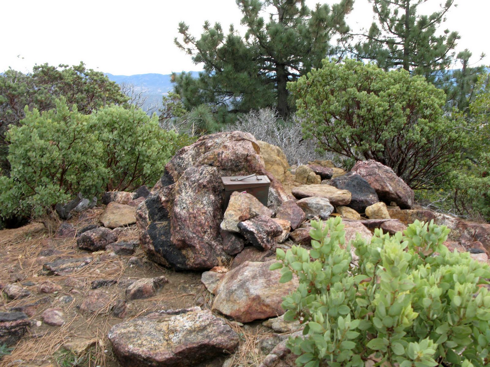
Continuing along the trail, it got easy at this point.After a split in the trail that is supposed to take you to a spring which I did not go far enough to see, I continued up the final part of the trail as it started to elevate.The summit box to write my signature.The views were blocked by trees in some of the directions. Another reason this did not feel like a mountain climb, but I did get to see some of the main areas I was after.
looking down to the southeast.
Zooming in. We drove by this earlier in the morning to get to the trailhead.We shall be near there in #33 of this series.

This ends the mountain hike. While not a major one, it was a good relaxing one that I enjoyed doing.

Ramona Epic #32: Cahuilla Mountain (Youtube Version)

The background music for this one is called Lightless Dawn from Incompetech.com.

Saturday, November 19, 2011

Ramona Epic #32: Cahuilla Mountain (Part 2)

Continuing from where I left off in the last blog, this is looking toward the east. All the roads you see were what we came up on. The road in the middle of the picture that runs from the south to the north is the one we took from the highway.This is looking back at where I had come from.

It is not too long after the above picture that the hike started to flaten out for a while. Again, this was not a major elevation hike, but it did have some uphill. It started to get a little more foresty here.
This came across as an odd site as we went through.
Speaking of odd, I thought this was so odd that I thought these types of manzanita trees had what looked like a "rubber" outside layer to them. That was my first impression of them. The outer layer of the wood had a dark red/brown look to them in such a way that they stood out as if they had just been painted. The picture does not really give you the impressions we had at the time, but it did stand out for us as we went by them.
As we continued through this area, the hike was getting easier. In the distance of the following picture you can see my brother as a small dot on the left. Originally, I thought the hike would end by climbing up to the summit just to the left of him.
That turned out not to be the case. We tried that route, but we quickly realized that was not the way. So, we got back on the path where you see him standing and continued in that direction.
I finish this one up tomorrow.


Ramona Epic #32: Cahuilla Mountain (Youtube Version)

Thursday, November 17, 2011

Ramona Epic #32: Cahuilla Mountain (Part 1)

(GPS: N33 35.785 W116 46.830)

In the next flew blogs I will be covering my hike up Cahuilla Mountain. The hike to Juan Diego's home and murder did not take that long. After coming back to the trailhead, I knew I had more than enough time to follow the trail to the top of Mt. Cahuilla. The elevation gain was not that dramatic. I'm talking of just about a 1000+ feet of elevation from the trailhead. When one thinks of a mountain hike this is usually not what they are thinking. It is listed on the Hundred Peaks Section Peak List, so take that for what it is worth.

I just enjoyed it since it was in an area I had never been to, and it was relaxing all the same. The downside was the day was very overcast to give it that gloomy look. As I stated in the last blog, this was probably for the better since it added the mood to what I was trying to portray regarding the death of Juan Diego. Still, it would have been nice to have had the sun out.
I am presenting this as part of the Ramona series because it connects episode #31 with #33 that will come after this hike. It gives you more understanding of the terrain that Juan Diego and his wife lived at. Other than that, it was just a fun hike. So, take it whatever way you want.

Back to the trailhead...in the previous entries on the Juan Diego home and murder, the hike continues off to the right. This time I would be heading up the mountain to the left of the sign.
After getting some elevation I looked back at the road I had gone on in the previous entries. I was on both roads you see, but to get to where I was last time you head down the road that looks like an "s".That is Mt. San Jacinto which I covered sometime back for this series. So, that is where the fictional story took place, but the historical mountain that the incident the Ramona story was based on was this one.This is looking into the direction that I had been at earlier. It is close to where I ended up in the previous entries at Juan Diego Flats.
Looking back to the cars at the trailhead. Mt. San Jacinto is in the distance.This begins the long part of the trail where you can see far out in front of you.It goes around like this and just keeps going. Nothing too difficult though, it just takes the time to do it.I will continue this one next time.

Ramona Epic #32: Cahuilla Mountain (Youtube Version)

Saturday, November 12, 2011

Ramona Epic #31: The Murder of Juan "Alessandro" Diego (Part 2)

(N33 35.655 W116 48.145)

In the previous blog I showed a road that continued to the final destination. In reality, it was less than five minutes to go down the road and take a left to this:

At this point, far enough away from civilization, just to the left of the above picture is this.You can click the picture (or, right click and open in a new window) to see that it says:

JUAN DIEGO FLATS
In this valley a conflict between the culture of the Indian and the White Man resulted in the death of Juan Diego (Alessandro in the play Romona [Sic]) by the hands of Sam Temple.
Billy Holcomb Chapter
E. Clampus Vitus
May 1979

The above is just looking into the open field near the monument.

What happened here is Juan Diego returned home from San Jacinto with the wrong horse. Apparently, having one of his mental spells, left his pony at a stable in San Jacinto, and then took a gray work horse back home. Unfortunately, this horse belonged to Sam Temple. Temple was a rough man that had been in fights before, and had a temper, especially when drunk. So, the very next morning, March 24, 1883, Temple went the 16 miles up into Juan Diego Flats. He got his horse back, but then killed Juan Diego with his guns.

Sam Temple claimed that it was self-defense and that Juan Diego confronted him with a knife. Juan's wife was not allowed to testify against Temple. As pointed out in the article I will link below, while technically an Indian could testify in court against whites, in practice for that time it was not allowed. So, Temple was able to get away with murder.

Helen Hunt Jackson did know of this event and wrote an article about it called, "Justifiable Homicide in Southern California". Eventually, the outrage of this historical event is what led her to use it in her fictional setting with the names of the people changed to the characters in her book that was published the very next year.

As I began the last blog, I really enjoy going into backcountry areas to find these types of tributes to the past. The area has probably not changed very much since the time of Juan Diego and his wife living there. The day I went the clouds were out to make it overcast. Due to the way schedules work out I had already committed myself to come here on the day I did it. So, I was sort of disappointed I did not have a sunny day. Then after thinking about it and looking back at what I was trying to do for this series, maybe having a gloomy day was for the best in how this worked out.

The Murder of Juan "Alessandro" Diego (Youtube Version)

The background music for this one is called Wounded by Incompetech.com.

The Killing of Juan Diego: From Murder to Mythology by Phil Brigandi and John W. Robinson (The best article about the history of this event from The Journal of San Diego History)

Friday, November 11, 2011

Ramona Epic #31: The Murder of Juan "Alessandro" Diego (Part 1)

(GPS: N33 35.755 W116 48.095)

When I created the Youtube channel for Ramona a year ago today I knew it would take me a year to be able to show something about this particular adventure. I had almost all the fieldwork done for the series, and it was just a matter of preparing everything at the computer. In order to do this series the way I wanted to present it, I knew that some of my favorite parts of this series would not come until about now.

If you have read some of my blog, you will know that my real favorite places are the ones where you go into the backcountry where few people go, and find something unique. Whether it is some human artifact remains or just something really beautiful to look at, I enjoy those times more than anything else I cover on this blog.

This was one of those times. I kind of knew what to expect based on an article I have (I will link it below) and a book or two. The hiking part of it was not that difficult relative to what I normally do, in fact I considered it quite easy, but the drive to get to the trailhead was a rough and bumpy ride. On this day, my brother drove me to the other side of Cahuilla Mountain seen below:
The above picture is taken near Anza, CA. Almost everything you will see in the next few blogs took place on the other side of that mountain. The picture below is very close to the trailhead. We hiked to two different areas from here. While you do see a vehicle in the distance, I would not suggest driving on these roads unless you know exactly where you are going and what your vehicle is capable of.For example, while hiking along the road we were taking I saw drops and turns that would be very dramatic for many cars.The hike was rather easy on the way because we dropped down some elevation, not much, but it would take a little more work coming back than getting here. After about 45 minutes or so, we came to the following:In the above picture, just ahead and around the corner on the left, was the final destination for the first hike. That will be in the next blog.

The whole idea of coming out here was to explore the location that was the inspiration for the murder of Alessandro in Helen Hunt Jackson's Ramona book. In this area, on the day of March 24, 1883, Juan Diego was murdered by Sam Temple in the area you are seeing. Like the fictional story, Juan Diego was an Indian (a Cahuilla Indian) that had mental lapses that would cause him to do very irrational things. He was a likeable person to everything that knew him, but they also knew he was a little nutty. Like Alessandro in the novel, he worked as a sheep shearer and other jobs for the locals. This area is named after him in that it is called Juan Diego Flats.

In the above picture, there is a short side road off to the right that goes uphill some and then stops. It was here I investigated this area for what looked like human activity at some point in the past. I am at this spot in this next picture, and it also is looking in the direction of what I will show in the next blog. Now whether Juan Diego and his wife lived right here at their adobe I do not know. The little map in the article makes it look like I would have been really close; the map is not totally to scale, but it would make sense. Then just turning around I had this behind me; far in the background is where the hike started from.
So the remains and foundations of something are still here. What it was exactly that was here I do not know. The bigger picture that I just wanted to experience on this day is to see the area of where Juan Diego and his wife lived and where he was murdered. I will continue this in the next blog.

The Murder of Juan "Alessandro" Diego (Youtube Version)

The Killing of Juan Diego: From Murder to Mythology by Phil Brigandi and John W. Robinson (The best article about the history of this event from The Journal of San Diego History)