Tuesday, October 31, 2006

“The Bridge to Nowhere” Hike Part 3 (The Halloween Series)

(GPS: N34 16.990 W117 44.810)

Okay, the above gps cords are for where we ended up at the bridge.

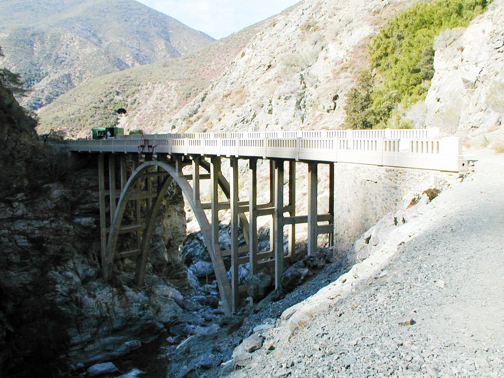
There was not much room around here, but I was safe. Again this is looking down from the “Nowhere” side.
Both of these are looking more from the northern side.
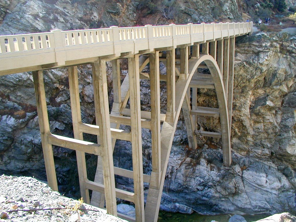
Looking at the “Nowhere” side.
This is the mysterious cable car thing overhead that goes over the bridge.
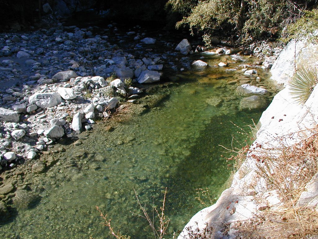
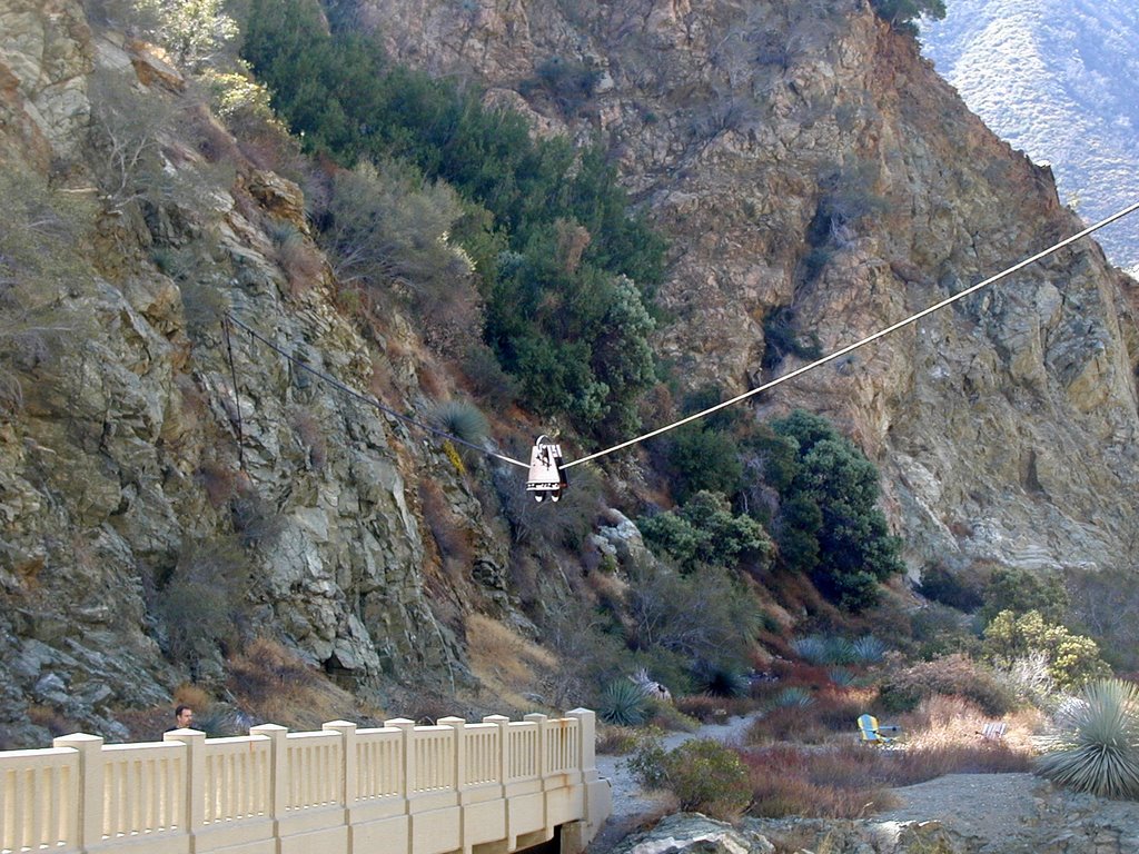
Looking down into the pool.
Looking back to the bridge from the southern side of "nowhere".
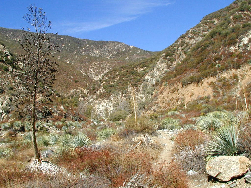
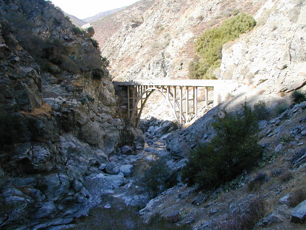
The following is just past the bridge into the “Nowhere” side. I followed the trail up a few hundred feet. It came to a point that was steep, but slippery. So, I could have forced the issue to continue, but I had all my camera gear out and did not want to risk things coming down. So, this is really as far as I got. Basically, you can go up further up the canyon to the left. Some backpackers continued on this way.
This is another angle looking down from the bridge. I took this as we were leaving.
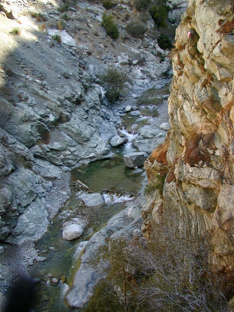
Early on I was sort of complaining about the pack of hikers that were slower. Well, they really weren’t a problem. They just were bungee jumpers who were not your typical hikers so they were rather slow at times. They started before us and we passed them. At one point we went up a little too high and had to back track. They were there so we had to pass them again. We saw some while we were heading back as they continued to reach the bridge.

People actually come to the bridge to bungee jump. We wanted to see them do it, but we had already been there almost an hour, and they were still slow setting up. One thing that I encountered here on the way back was people constantly asking me how many miles it would take to get to the end. You could tell many people do not get out walking or hike much. I have never encountered this on any of my other hikes. In fact, some big guys at the trail-head were trying to convince my brother that it was, “a lot harder and further than you thought it was, right?”

He said he was just being agreeable to be polite, but I would have to agree that this hike was really not that hard. We were in an out in about 4 hours. We could have done it quicker too. The only problems are you have to cross water a lot, walk on stones and sand. It is nothing compared to everything else I have written about.


Just as a follow up to my first entry. Here is the video that “Cassie” used to show her dead drop at the Bridge. It looks like it was just across the bridge in a bunch of rocks. In fact, I was standing right near where he shot the last part of this video.

http://www.youtube.com/watch?v=zaa5wqXszZM

Had there not been as many people on this hike I think the creepiness factor would have been "higher" walking around in this area. People were out fishing and prospecting(!) along the river. Funny, we never saw any fish. Still a well made bridge out in the middle of nowhere is just strange! Well, this ends my Halloween series. Happy Halloween!

“The Bridge to Nowhere” Hike Part 2 (The Halloween Series)

(GPS: N34 16.260 W117 44.815)

As you can see we continued to cross the river at different points:
We never did see the Swan Canyon part because I forgot to look, but along the walls you can notice different types of veins in the rock. There is a part somewhere along this hike where you can see something that looks like a Swan with the different type of rocks. Here is the best I can do to show the type of rock.
At this point is near where the gps cords are at this riverbed area. We are later in the year so the water is down quite a ways. If you look to the right you see the final ascent on a trail over the canyon.

We ran across a PACK of hikers along the way and I was glad to see some uphill at this point. I knew we would lose them in the uphill since we do that all the time. I’ll explain more about these hikers later. We were still pretty fast, but there were certain areas that we had to slow down because of their slow crossings. It was not that big a deal, but we like to go as fast as possible on these hikes.
This is looking back down the canyon from where we came:
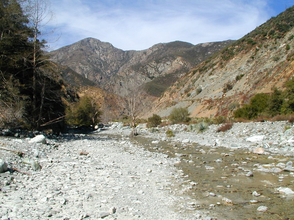
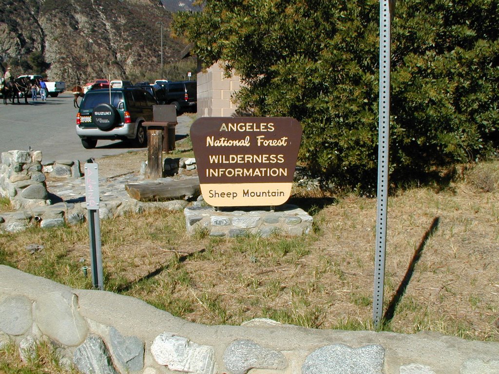
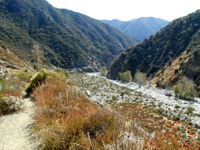
Okay, we finally made it in about 2 hours which is pretty good time. Normally it is supposed to take somewhere from 3 ½ to 4 hours to get there, but I suspect the people that do that are trying to avoid getting wet and are not people that hike high elevations very much. The difference in this hike is it is just crossing the river about 10 times and walking on sand and rocks for about 5 miles. Here is what we came to see after we crossed it to the “Nowhere” side:
This is the Bridge to Nowhere. It was made in 1936. This whole drainage trail we hiked was supposed to be a road that was intended for another way out of Los Angeles into the Palmdale area. The problem was that in 1938 a massive rainstorm hit with 12 inches in less than a day. All the rain buildup led to a major flood in the canyon knocking at all the construction work and road in the canyon. However, the height of this bridge was just enough to avoid being destroyed.

This is still on the “Nowhere” side looking back. This bridge is really out of place here. It is not used for anything because the road was wiped out. Hikers do use the road and the trail does continue on, but to where I am not sure since I did not bother going more than few hundred feet further.
This is looking down.

Monday, October 30, 2006

“The Bridge to Nowhere” Hike Part 1 (The Halloween Series)

(GPS: N 34 14.210 W 117 45.920)

This is a hike I have wanted to do for a long time. It sounds spooky and some unusual things have happened here. This hike is great, but notorious for a few reasons which will come out in the next few entries. What better time of the year than to do this in October. Note: the gps cords above are just for the trail-head; the next two in each entry are further on into the hike until the end.

I wanted to do this hike early in the morning, but unfortunately my brother and I could not get an earlier start than 9:00 am. So, we headed up Azuza Canyon into the mountains on a winding road past two reservoirs. We then crossed the East Ford Road to the Sheep Mountain trail-head.

This side story is a little too complicated to go into here, but over the summer there was something that came out called “Lonelygirl15”. It is still going on about a girl who posts video’s of herself on youtube. It came out it was a fictional story, but one of the videos were filmed down below this picture in the pools.
The video they used of that area:

http://www.youtube.com/watch?v=5Q_y0HdJ4x8

Interesting enough, a side story of Lonelygirl15 called “Cassieiswatching” also filmed a scene in her video near where we went. Items were left in sort of a geocache/dead drop scavenger hunt. A little more on the creepy side of things…

http://www.youtube.com/watch?v=_IcYUifgEfw

From what I could tell I could have found the items rather easily, but I don’t just drop everything and drive out to places to get things like that.

Funny thing is people around the world were really creeped out over all of this because of the “Cassie” videos and the names of the locations like Caves to Nowhere, Tunnel to Nowhere, and Bridge to Nowhere. However, for those who live in Southern California there is nothing to be scared about other than an abundance of rattlesnakes. These areas are not creepy in the way people were thinking since these are rather well traveled areas.

This is only within the first five minutes of the hike. You can see what used to be a bridge that crossed the river here. Notice the connector on the other side. This area marks the first river crossing one must do on this trail.
There are actually many river crossings one must do and as you do them you see many pools of water that look nice for swimming or wading.
Here is another example of the water. Sometimes you encounter water that is a lot faster and deeper. Although we tried to avoid the water it got to the point we did not care too much and would just wade through. I do not think it ever got higher than three feet at areas we crossed. At some points it was higher, but we avoided those.
As we went further back and forth across the river we found another old bridge that had been wiped out:
At some points we were able to avoid water for while. We just followed the canyon
But, in some areas we had to straddle the walls over the water like this.
More to come in my next entry of this interesting, but kind of spooky hike tomorrow.

The Whaley House Part 2 (The Halloween Series)

(GPS: N 32 45.150 W 117 11.670)

(Note: these pictures are from the last 1990's. Since that time a new organization has taken over and the insides of the house are much different. I enjoyed the Whaley House at the time I did this, but the changes and new policies I do not agree with and cannot with good conscience recommend spending your money on touring this house as it now is.)

I mentioned a few of the ghosts that supposedly haunt the place. I mentioned them all the last time, but the main ones are Mr. Thomas and Anne Whaley, "Yankee Jim", and the Washburn Girl are the alleged spirits that one encounters the most there. Of course, there are others people have claimed to see. All sorts of noises have been heard.

Okay, so now I went upstairs. There were a few rooms up there, but they have a glass window that blocks you from entering the rooms.
The one above just looks spooky because there is no head there. Lol! Wouldn't it be great if you were there and a spirit of a head just happened to attach itself!
An interesting period uniform.
There were lots of old painting in the house as well as China.
This last picture I always make sure people look at. What is that mysterious shadow on the left side. Looks like a ghost! Well, I guess. Really, since they have all those windows in place that is just a reflection of my brother. I thought I would be honest rather than say, "what is that?" and leave it blank here.

Edit: I noted the Washburn Girl as an alleged ghost in this house. While some girl may have told someone this story at the house, the alleged history of her running into a low clothesline in the backyard is untrue. This is the problem one encounters when real history is confused with ghost history someone hears about. Do these ghosts get their facts mixed up, or do they just like to tell fiction sometimes. ;)

Anyways, tomorrow will be my grand finale on Halloween with my special Halloween Hike I did. Stay tuned...

Sunday, October 29, 2006

The Whaley House Part 1 (The Halloween Series)

(GPS: N 32 45.150 W 117 11.670)

(Note: these pictures are from the late 1990's. Since that time a new organization has taken over and the insides of the house are much different. I enjoyed the Whaley House at the time I did this, but the changes and new policies I do not agree with and cannot with good conscience recommend spending your money on touring this house as it now is.)

Another really fun, but spooky place to visit is the Whaley House. In the 1960’s the U.S. Department of Commerce gave the house “officially haunted” status. Some claim it may be the most haunted house in the U.S.
In 1852, a man named “Yankee Jim” Robinson was hung at the site for attempting to steal a boat. Unfortunately, it was not a quick and painless death as it is reported it took 45 minutes for him to be strangled to death. Stories have come out that he now haunts the house. His heavy boot steps have been heard, people feel the tightness of a rope around their neck between the parlor and the music room, as well as his ghost being seen.

In 1857, Thomas Whaley and family, moved to the property and the house was built. Unfortunately, the youngest child, Thomas Jr. died of scarlet fever at 17 months. Stories have come out of people hearing a child crying from his room upstairs where he died.
I had to tweak the above picture to brighten it since it was really dark. It is rare for me to shoot inside of a house and I can't remember if they had rules on flash photography or not. Anyways, the above is the Andrew Jackson sofa which, naturally, belonged to Andrew Jackson when he was alive. It is here that tv entertainer Regis Philbin "saw" Anna Whaley (husband of Thomas) sitting there at 2:30 am.
The above is the Gone with the Wind piano taken from the movie of course. There are stories of the music box (to the right) playing and the piano playing in this room by themselves.
I believe the above is the dining room.
What is interesting is that the house was used as the San Diego Courthouse. When you enter the house it is to the left past the dining room. There are a lot of old 19th century trinkets in this room. I remember seeing some Civil War items. The arm above is just my brothers and nothing to freak out about. However, there are stories of sounds of lots of people moving around in here. There is a picture on the net where a person claims to have seen something that looks like a ghost.
Still in the courtroom. What is interesting here is that little face you can see in the middle right side of the picture. That would be this:
Ignoring the shadow of me shooting the picture, this is a mask of Abraham Lincoln. The Whaley House owns 1 of 6 of them. Cool, but kind of creepy! Originally, when I wrote this entry I was under the impression this was a "death mask" because that was what I was told, but I have since learned that this is a myth. Please click this LINK about the history of the two masks Lincoln had done.

Tomorrow I will show what the upstairs looks like at the Whaley House.

Monday, October 23, 2006

The Grasseaters (The Halloween Series)

(AKA as Societas Fraterna)
(GPS: N33 53.445 W117 52.525)
Since we are close to Halloween I thought I would have a few entries that are a little on the “creepy” side. In fact, some of the action took not too far from where I live most of the year.

In the year 1876, George Hinde thought he was being led by “spirits” to a new paradise. He purchased 24 acres on the corner of what is now Placentia Ave. and Palm Drive. He built a two story, fourteen room mansion. This was no ordinary mansion though because the plan was unique to the area. It had a tower on top of it. It is said that all the rooms were circular to keep bad spirits hiding from the corners, but it was reported that only the tower’s rooms were circular. Here is how it looked:In 1878, a Dr. Louis Schlesinger arrived and joined up with Hinde. They intended to create a great society called Societas Fraterna. Their beliefs consisted of a diet of fruits and vegetables that were eaten raw. Cooking was not allowed because it destroyed the spiritual essence and nutrition of the food. This is why they were known as the Grasseaters. People came from long distances to purchase the fruits and vegetables they raised. Dr. Schlesinger also believed that marriage was unnecessary and they were accused of practicing “free love”.
The community was not pleased with the local spiritualist cult. In May, 1879 a report got out that a baby starved to death because the only food given to the child was the diet of a scraped apple. The baby did not die, but was in a weak state. After much controversy and a court case the charges against the society were dropped since there had been no intent to murder. Still Dr. Schlesinger agreed to modify their way of life.

Schlesinger eventually moved a way a few years after this incident. The society continued even after Hinde and family died until the early 1920’s. In 1931, the house was knocked down and the property sold. John Nenno purchased some of the land and his house still stands today:

The area where the Hinde house would have been is just across the street from the Nenno House. Just across the street in the upper middle of this picture.
The only trace left in Placentia that we have of these people is this plaque which shows the oldest Macadamia tree in California. This is where the gps cords point to in this little residential area south of where the original house was at. The used the macadamia trees to produce nuts for their diet.

Of course, these things are the only material things left of these people. I forgot to mention that it was revealed that they buried their dead in the backyard of their land. Skeletons were dug up on the property before they tore it down. They did have séances at this house. Dr. Schlesinger did believe he could converse with the dead. An investigation took place over a missing man, Ross Weiderhold, a former society resident who went back to get his brother. His brother had already died in Long Beach, but Ross was never seen or heard of again. And, there are folk tales of ghosts, and the Placentia Ghost in the area which originates with these stories.

The best source of information on this cult is the book Placentia: A Pleasant Place by Virginia L. Carpenter.

Tuesday, October 17, 2006

Cloud's Rest Hike (Part 3)

(GPS: N 37° 46.065 W 119° 29.355)

One thing I had read about before we actually hiked up there is that there was a "domesticated" chipmunk living up there. That was from the year before. When we got there we were quickly greeted by the following fellow. We called him Paco the bandit. He gets right next to hikers expecting food or will hop right on your backpack to get what he is after. I have never seen any wild animal as friendly as this. The funny thing is that I even heard and saw a picture about him doing the same thing this year.
This is looking more to the northeast.
This is looking more to the north.
This is looking more to the north west.
I never felt in danger, and it would be hard to mess up, but imagine stumbling along a rock around here.
It is a long drop down.
Looking to the West. Half-Dome is such a great view from here.
A zoom in on the main feature. As I mentioned in an earlier entry, this was not that difficult of a hike since it is all trail to the top. One day I hope to look at they area I stood here from Half-Dome.